San Andrés Ixtlán geodata
San Andrés Ixtlán (Jalisco) is a populated place; located in Mexico in America/Mexico_City (GMT-6) time zone. With population of 5,230 people, there are 1769 cities with bigger population in this country. Compared to other cities in Mexico, 53.3% of cities are located further ↓South; 88.2% of cities are located further →East and 53.3% of cities have lower elevation than San Andrés Ixtlán. Note1


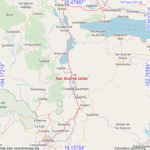
San Andrés Ixtlán GPS coordinates[2]
19° 49' 11.568" North, 103° 28' 8.616" West
| Map corner | latitude | longitude |
|---|---|---|
| Upper-left | 20.47997°, | -104.17219° |
| Center: | 19.81988°, | -103.46906° |
| Lower-right: | 19.15704°, | -102.76594° |
| Map W x H: | 147.1×147.1 km | = 91.4×91.4mi |
| max Lat: | 32.7° ⇑46.7% North |
| San Andrés Ixtlán: | 19.81988° |
| min Lat: | ⇓53.3% South 14.53588° |
| min Long | San Andrés Ixt | max Long |
| -117.105° | -103.46906° | -86.73105° |
| W 11.8%⇐ | ⇒88.2% E |
Elevation
Elevation of San Andrés Ixtlán is 1546 m = 5072 ft, and this is 292.3 m = 959 ft above average elevation for this country.
| Max E: |
3497 m = 11473 ft | 46.7% |
| San Andrés Ixtlán | 1546 m 5072 ft | |
| Avg. | 1253.7 m = 4113 ft | |
Min E: |
-1 m = -3 ft | 53.3% |
See also: Mexico elevation on elevation.city.
Geographical zone
San Andrés Ixtlán is located in North Torrid zone (between Equator and Tropic of Cancer). Distance of this Northern Tropic circle is 402.2 km =249.9 mi to North.| Distance of | km | miles | from San Andrés Ixtlán |
|---|---|---|---|
| North Pole | 7803.3 | 4848.7 | to North |
| Arctic Circle | 5197.4 | 3229.5 | to North |
| Tropic Cancer | 402.2 | 249.9 | to North |
| Equator | 2203.8 | 1369.4 | to South |


Nearby cities:
15 places around San Andrés Ixtlán: (largest is in red/bold)
• Atoyac
21.7 km =13.5 mi,  346°
346°
• Ciudad Guzmán
12.8 km =8 mi,  176°
176°
• Ciudad Guzmán [CERESO]
19 km =11.8 mi,  189°
189°
• Cuyacapan
17.4 km =10.8 mi,  340°
340°
• El Rincón
18.3 km =11.4 mi,  157°
157°
• El Rodeo
4.2 km =2.6 mi,  55°
55°
• Gómez Farías
3 km =1.9 mi, 194°
• La Mesa (El Fresnito)
22.5 km =14 mi, 192°
• San Sebastián del Sur
2.9 km =1.8 mi, 188°
• Sayula
15.4 km =9.6 mi,  296°
296°
• Soyatlán de Afuera
24.2 km =15 mi,  126°
126°
• Unión de Guadalupe
10.2 km =6.3 mi,  10°
10°
• Usmajac
9.7 km =6 mi,  309°
309°
• Vista Hermosa
19.5 km =12.1 mi,  135°
135°
• Zapotiltic
22.1 km =13.7 mi,  165°
165°
Sources, notices
• [Note1] Compared only with cities in Mexico existing in our database
• [Src1] Map data: © OpenStreetMap contributors (CC-BY-SA)
• [Src2] Other city data from geonames.org with taken over terms of usage.
• [Src3] Geographical zone / Annual Mean Temperature by Robert A. Rohde @ Wikipedia
