Cuyacapan geodata
Cuyacapan (Jalisco) is a populated place; located in Mexico in America/Mexico_City (GMT-6) time zone. With population of 946 people, there are 9202 cities with bigger population in this country. Compared to other cities in Mexico, 56.4% of cities are located further ↓South; 88.4% of cities are located further →East and 51.6% of cities have higher elevation than Cuyacapan. Note1


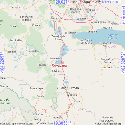
Cuyacapan GPS coordinates[2]
19° 58' 3.144" North, 103° 31' 25.824" West
| Map corner | latitude | longitude |
|---|---|---|
| Upper-left | 20.627°, | -104.22697° |
| Center: | 19.96754°, | -103.52384° |
| Lower-right: | 19.30531°, | -102.82072° |
| Map W x H: | 147×147 km | = 91.3×91.3mi |
| max Lat: | 32.7° ⇑43.6% North |
| Cuyacapan: | 19.96754° |
| min Lat: | ⇓56.4% South 14.53588° |
| min Long | Cuyacapan | max Long |
| -117.105° | -103.52384° | -86.73105° |
| W 11.6%⇐ | ⇒88.4% E |
Elevation
Elevation of Cuyacapan is 1356 m = 4449 ft, and this is 102.3 m = 336 ft above average elevation for this country.
| Max E: |
3497 m = 11473 ft | 51.6% |
| Cuyacapan | 1356 m 4449 ft | |
| Avg. | 1253.7 m = 4113 ft | |
Min E: |
-1 m = -3 ft | 48.4% |
See also: Mexico elevation on elevation.city.
Geographical zone
Cuyacapan is located in North Torrid zone (between Equator and Tropic of Cancer). Distance of this Northern Tropic circle is 385.7 km =239.7 mi to North.| Distance of | km | miles | from Cuyacapan |
|---|---|---|---|
| North Pole | 7786.9 | 4838.6 | to North |
| Arctic Circle | 5181 | 3219.3 | to North |
| Tropic Cancer | 385.7 | 239.7 | to North |
| Equator | 2220.2 | 1379.6 | to South |


Nearby cities:
15 places around Cuyacapan: (largest is in red/bold)
• Amacueca
9.3 km =5.8 mi,  301°
301°
• Atoyac
4.7 km =2.9 mi,  9°
9°
• El Rodeo
16.8 km =10.4 mi,  146°
146°
• Gómez Farías
20 km =12.4 mi,  165°
165°
• Juanacatlán
18.5 km =11.5 mi,  293°
293°
• San Andrés Ixtlán
17.4 km =10.8 mi,  160°
160°
• San Antonio
19.3 km =12 mi,  269°
269°
• San José de Gracia
16.9 km =10.5 mi,  30°
30°
• San Sebastián del Sur
20 km =12.4 mi, 164°
• Sayula
12.4 km =7.7 mi,  220°
220°
• Techaluta de Montenegro
12.1 km =7.5 mi,  346°
346°
• Teocuitatlán de Corona
20.6 km =12.8 mi,  47°
47°
• Tepec
12.5 km =7.8 mi,  281°
281°
• Unión de Guadalupe
9.9 km =6.2 mi,  130°
130°
• Usmajac
10.5 km =6.5 mi,  189°
189°
Sources, notices
• [Note1] Compared only with cities in Mexico existing in our database
• [Src1] Map data: © OpenStreetMap contributors (CC-BY-SA)
• [Src2] Other city data from geonames.org with taken over terms of usage.
• [Src3] Geographical zone / Annual Mean Temperature by Robert A. Rohde @ Wikipedia
