Pajacuarán geodata
Pajacuarán (Michoacán) is a seat of a second-order administrative division; located in Mexico in America/Mexico_City (GMT-6) time zone. With population of 10,014 people, there are 952 cities with bigger population in this country. Compared to other cities in Mexico, 59.6% of cities are located further ↓South; 84.4% of cities are located further →East and 52.2% of cities have lower elevation than Pajacuarán. Note1


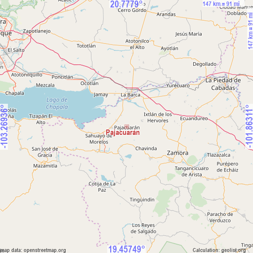
Pajacuarán GPS coordinates[2]
20° 7' 8.724" North, 102° 33' 58.428" West
| Map corner | latitude | longitude |
|---|---|---|
| Upper-left | 20.7779°, | -103.26936° |
| Center: | 20.11909°, | -102.56623° |
| Lower-right: | 19.45749°, | -101.86311° |
| Map W x H: | 146.8×146.8 km | = 91.2×91.2mi |
| max Lat: | 32.7° ⇑40.4% North |
| Pajacuarán: | 20.11909° |
| min Lat: | ⇓59.6% South 14.53588° |
| min Long | Pajacuarán | max Long |
| -117.105° | -102.56623° | -86.73105° |
| W 15.6%⇐ | ⇒84.4% E |
Elevation
Elevation of Pajacuarán is 1528 m = 5013 ft, and this is 274.3 m = 900 ft above average elevation for this country.
| Max E: |
3497 m = 11473 ft | 47.8% |
| Pajacuarán | 1528 m 5013 ft | |
| Avg. | 1253.7 m = 4113 ft | |
Min E: |
-1 m = -3 ft | 52.2% |
See also: Mexico elevation on elevation.city.
Geographical zone
Pajacuarán is located in North Torrid zone (between Equator and Tropic of Cancer). Distance of this Northern Tropic circle is 368.9 km =229.2 mi to North.| Distance of | km | miles | from Pajacuarán |
|---|---|---|---|
| North Pole | 7770 | 4828.1 | to North |
| Arctic Circle | 5164.1 | 3208.8 | to North |
| Tropic Cancer | 368.9 | 229.2 | to North |
| Equator | 2237 | 1390 | to South |


Nearby cities:
15 places around Pajacuarán: (largest is in red/bold)
• Cerrito Colorado
13.1 km =8.1 mi,  162°
162°
• El Fortín
7.7 km =4.8 mi,  332°
332°
• El Paracho
4.7 km =2.9 mi,  104°
104°
• El Platanal
6.5 km =4 mi,  190°
190°
• El Valenciano
11.9 km =7.4 mi,  73°
73°
• La Cuestita
9.9 km =6.2 mi,  127°
127°
• La Luz
9.2 km =5.7 mi, 66°
• La Magdalena
12.6 km =7.8 mi,  307°
307°
• Las Zarquillas
9.3 km =5.8 mi,  152°
152°
• Morelos
6.7 km =4.2 mi,  299°
299°
• Pueblo Viejo
4.4 km =2.7 mi,  280°
280°
• San Gregorio
8.6 km =5.3 mi,  12°
12°
• Tecomatán
7.3 km =4.5 mi,  93°
93°
• Venustiano Carranza
9.2 km =5.7 mi,  267°
267°
• Villamar
11.4 km =7.1 mi,  196°
196°
Sources, notices
• [Note1] Compared only with cities in Mexico existing in our database
• [Src1] Map data: © OpenStreetMap contributors (CC-BY-SA)
• [Src2] Other city data from geonames.org with taken over terms of usage.
• [Src3] Geographical zone / Annual Mean Temperature by Robert A. Rohde @ Wikipedia
