Ocotlán geodata
Ocotlán (Jalisco) is a seat of a second-order administrative division; located in Mexico in America/Mexico_City (GMT-6) time zone. With population of 83,769 people, there are 153 cities with bigger population in this country. Compared to other cities in Mexico, 64.6% of cities are located further ↓South; 85.1% of cities are located further →East and 52.5% of cities have lower elevation than Ocotlán. Note1


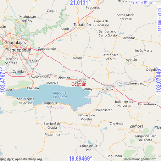
Ocotlán GPS coordinates[2]
20° 21' 19.08" North, 102° 46' 24.888" West
| Map corner | latitude | longitude |
|---|---|---|
| Upper-left | 21.0131°, | -103.47671° |
| Center: | 20.3553°, | -102.77358° |
| Lower-right: | 19.69469°, | -102.07046° |
| Map W x H: | 146.6×146.6 km | = 91.1×91.1mi |
| max Lat: | 32.7° ⇑35.4% North |
| Ocotlán: | 20.3553° |
| min Lat: | ⇓64.6% South 14.53588° |
| min Long | Ocotlán | max Long |
| -117.105° | -102.77358° | -86.73105° |
| W 14.9%⇐ | ⇒85.1% E |
Elevation
Elevation of Ocotlán is 1532 m = 5026 ft, and this is 278.3 m = 913 ft above average elevation for this country.
| Max E: |
3497 m = 11473 ft | 47.5% |
| Ocotlán | 1532 m 5026 ft | |
| Avg. | 1253.7 m = 4113 ft | |
Min E: |
-1 m = -3 ft | 52.5% |
See also: Ocotlán elevation on elevation.city.
Geographical zone
Ocotlán is located in North Torrid zone (between Equator and Tropic of Cancer). Distance of this Northern Tropic circle is 342.6 km =212.9 mi to North.| Distance of | km | miles | from Ocotlán |
|---|---|---|---|
| North Pole | 7743.8 | 4811.8 | to North |
| Arctic Circle | 5137.9 | 3192.5 | to North |
| Tropic Cancer | 342.6 | 212.9 | to North |
| Equator | 2263.3 | 1406.3 | to South |


Nearby cities:
15 places around Ocotlán: (largest is in red/bold)
• Ahuatlán
13.8 km =8.6 mi,  300°
300°
• Cuitzeo (La Estancia)
1.8 km =1.1 mi,  217°
217°
• El Sauz
14.1 km =8.8 mi,  347°
347°
• Jamay
9.7 km =6 mi,  134°
134°
• Joconoxtle (La Tuna)
14.8 km =9.2 mi,  43°
43°
• La Noria
13.4 km =8.3 mi,  325°
325°
• La Zapotera
14.1 km =8.8 mi,  247°
247°
• Los Cerritos
13.6 km =8.5 mi,  358°
358°
• Otatlán
10 km =6.2 mi,  341°
341°
• San Andrés
3.7 km =2.3 mi,  120°
120°
• San Luis de Agua Caliente
6.1 km =3.8 mi, 300°
• San Martín de Zula
7.6 km =4.7 mi, 38°
• San Miguel de la Paz
11.7 km =7.3 mi,  81°
81°
• Santa Clara de Zula
8.4 km =5.2 mi,  45°
45°
• Santa Cruz el Grande
9.7 km =6 mi,  283°
283°
Sources, notices
• [Note1] Compared only with cities in Mexico existing in our database
• [Src1] Map data: © OpenStreetMap contributors (CC-BY-SA)
• [Src2] Other city data from geonames.org with taken over terms of usage.
• [Src3] Geographical zone / Annual Mean Temperature by Robert A. Rohde @ Wikipedia
