Otatlán geodata
Otatlán (Jalisco) is a populated place; located in Mexico in America/Mexico_City (GMT-6) time zone. With population of 1,280 people, there are 6771 cities with bigger population in this country. Compared to other cities in Mexico, 66.5% of cities are located further ↓South; 85.2% of cities are located further →East and 53.6% of cities have lower elevation than Otatlán. Note1


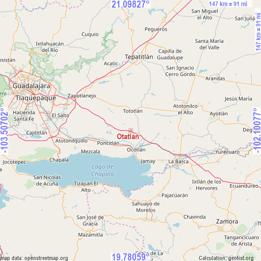
Otatlán GPS coordinates[2]
20° 26' 27.024" North, 102° 48' 14.004" West
| Map corner | latitude | longitude |
|---|---|---|
| Upper-left | 21.09827°, | -103.50702° |
| Center: | 20.44084°, | -102.80389° |
| Lower-right: | 19.78059°, | -102.10077° |
| Map W x H: | 146.5×146.5 km | = 91×91mi |
| max Lat: | 32.7° ⇑33.5% North |
| Otatlán: | 20.44084° |
| min Lat: | ⇓66.5% South 14.53588° |
| min Long | Otatlán | max Long |
| -117.105° | -102.80389° | -86.73105° |
| W 14.8%⇐ | ⇒85.2% E |
Elevation
Elevation of Otatlán is 1552 m = 5092 ft, and this is 298.3 m = 979 ft above average elevation for this country.
| Max E: |
3497 m = 11473 ft | 46.4% |
| Otatlán | 1552 m 5092 ft | |
| Avg. | 1253.7 m = 4113 ft | |
Min E: |
-1 m = -3 ft | 53.6% |
See also: Mexico elevation on elevation.city.
Geographical zone
Otatlán is located in North Torrid zone (between Equator and Tropic of Cancer). Distance of this Northern Tropic circle is 333.1 km =207 mi to North.| Distance of | km | miles | from Otatlán |
|---|---|---|---|
| North Pole | 7734.3 | 4805.9 | to North |
| Arctic Circle | 5128.4 | 3186.6 | to North |
| Tropic Cancer | 333.1 | 207 | to North |
| Equator | 2272.8 | 1412.3 | to South |


Nearby cities:
15 places around Otatlán: (largest is in red/bold)
• Ahuatlán
9.1 km =5.7 mi,  254°
254°
• Carrozas
8.9 km =5.5 mi,  56°
56°
• Coina Grande
11.2 km =7 mi,  34°
34°
• Cuitzeo (La Estancia)
11.1 km =6.9 mi,  169°
169°
• El Sauz
4.2 km =2.6 mi,  2°
2°
• La Noria
4.7 km =2.9 mi,  289°
289°
• Los Cerritos
5 km =3.1 mi,  35°
35°
• Ocotlán
10 km =6.2 mi,  161°
161°
• San Andrés
13 km =8.1 mi,  150°
150°
• San Luis de Agua Caliente
6.8 km =4.2 mi,  198°
198°
• San Martín de Zula
8.6 km =5.3 mi,  113°
113°
• Santa Clara de Zula
9.8 km =6.1 mi, 111°
• Santa Cruz el Grande
9.6 km =6 mi,  220°
220°
• Tototlán
11.3 km =7 mi,  6°
6°
• Zapotlán del Rey
13 km =8.1 mi,  282°
282°
Sources, notices
• [Note1] Compared only with cities in Mexico existing in our database
• [Src1] Map data: © OpenStreetMap contributors (CC-BY-SA)
• [Src2] Other city data from geonames.org with taken over terms of usage.
• [Src3] Geographical zone / Annual Mean Temperature by Robert A. Rohde @ Wikipedia
