El Sauz geodata
El Sauz (Jalisco) is a populated place; located in Mexico in America/Mexico_City (GMT-6) time zone. With population of 561 people, there are 15205 cities with bigger population in this country. Compared to other cities in Mexico, 67.3% of cities are located further ↓South; 85.1% of cities are located further →East and 53.9% of cities have lower elevation than El Sauz. Note1


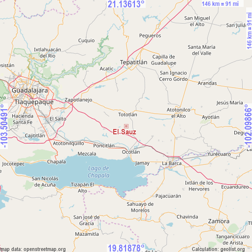
El Sauz GPS coordinates[2]
20° 28' 43.932" North, 102° 48' 6.408" West
| Map corner | latitude | longitude |
|---|---|---|
| Upper-left | 21.13613°, | -103.50491° |
| Center: | 20.47887°, | -102.80178° |
| Lower-right: | 19.81878°, | -102.09866° |
| Map W x H: | 146.5×146.5 km | = 91×91mi |
| max Lat: | 32.7° ⇑32.7% North |
| El Sauz: | 20.47887° |
| min Lat: | ⇓67.3% South 14.53588° |
| min Long | El Sauz | max Long |
| -117.105° | -102.80178° | -86.73105° |
| W 14.9%⇐ | ⇒85.1% E |
Elevation
Elevation of El Sauz is 1559 m = 5115 ft, and this is 305.3 m = 1002 ft above average elevation for this country.
| Max E: |
3497 m = 11473 ft | 46.1% |
| El Sauz | 1559 m 5115 ft | |
| Avg. | 1253.7 m = 4113 ft | |
Min E: |
-1 m = -3 ft | 53.9% |
See also: Mexico elevation on elevation.city.
Geographical zone
El Sauz is located in North Torrid zone (between Equator and Tropic of Cancer). Distance of this Northern Tropic circle is 328.9 km =204.4 mi to North.| Distance of | km | miles | from El Sauz |
|---|---|---|---|
| North Pole | 7730 | 4803.2 | to North |
| Arctic Circle | 5124.1 | 3184 | to North |
| Tropic Cancer | 328.9 | 204.4 | to North |
| Equator | 2277 | 1414.9 | to South |


Nearby cities:
15 places around El Sauz: (largest is in red/bold)
• Ahuatlán
11.2 km =7 mi,  233°
233°
• Carrozas
7.2 km =4.5 mi,  84°
84°
• Coina Grande
7.9 km =4.9 mi,  50°
50°
• Joconoxtle (La Tuna)
13.4 km =8.3 mi,  102°
102°
• La Noria
5.4 km =3.4 mi,  240°
240°
• Los Cerritos
2.7 km =1.7 mi,  93°
93°
• Nuevo Refugio de Afuera (Nuevo Refugio)
12.6 km =7.8 mi, 51°
• Otatlán
4.2 km =2.6 mi,  182°
182°
• San Isidro
13.7 km =8.5 mi,  40°
40°
• San Luis de Agua Caliente
10.9 km =6.8 mi,  192°
192°
• San Martín de Zula
10.9 km =6.8 mi,  135°
135°
• Santa Clara de Zula
11.9 km =7.4 mi,  131°
131°
• Santa Cruz el Grande
13.2 km =8.2 mi,  209°
209°
• Tototlán
7.1 km =4.4 mi,  8°
8°
• Zapotlán del Rey
13 km =8.1 mi,  263°
263°
Sources, notices
• [Note1] Compared only with cities in Mexico existing in our database
• [Src1] Map data: © OpenStreetMap contributors (CC-BY-SA)
• [Src2] Other city data from geonames.org with taken over terms of usage.
• [Src3] Geographical zone / Annual Mean Temperature by Robert A. Rohde @ Wikipedia
