Mismaloya geodata
Mismaloya (Jalisco) is a populated place; located in Mexico in America/Mexico_City (GMT-6) time zone. With population of 884 people, there are 9870 cities with bigger population in this country. Compared to other cities in Mexico, 60.5% of cities are located further ↓South; 86.1% of cities are located further →East and 52.4% of cities have lower elevation than Mismaloya. Note1


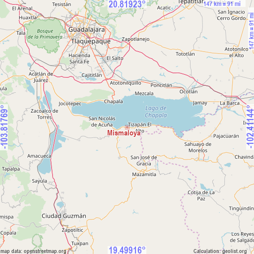
Mismaloya GPS coordinates[2]
20° 9' 38.124" North, 103° 6' 52.416" West
| Map corner | latitude | longitude |
|---|---|---|
| Upper-left | 20.81923°, | -103.81769° |
| Center: | 20.16059°, | -103.11456° |
| Lower-right: | 19.49916°, | -102.41144° |
| Map W x H: | 146.8×146.8 km | = 91.2×91.2mi |
| max Lat: | 32.7° ⇑39.5% North |
| Mismaloya: | 20.16059° |
| min Lat: | ⇓60.5% South 14.53588° |
| min Long | Mismaloya | max Long |
| -117.105° | -103.11456° | -86.73105° |
| W 13.9%⇐ | ⇒86.1% E |
Elevation
Elevation of Mismaloya is 1531 m = 5023 ft, and this is 277.3 m = 910 ft above average elevation for this country.
| Max E: |
3497 m = 11473 ft | 47.6% |
| Mismaloya | 1531 m 5023 ft | |
| Avg. | 1253.7 m = 4113 ft | |
Min E: |
-1 m = -3 ft | 52.4% |
See also: Mexico elevation on elevation.city.
Geographical zone
Mismaloya is located in North Torrid zone (between Equator and Tropic of Cancer). Distance of this Northern Tropic circle is 364.3 km =226.4 mi to North.| Distance of | km | miles | from Mismaloya |
|---|---|---|---|
| North Pole | 7765.4 | 4825.2 | to North |
| Arctic Circle | 5159.5 | 3206 | to North |
| Tropic Cancer | 364.3 | 226.4 | to North |
| Equator | 2241.6 | 1392.9 | to South |


Nearby cities:
15 places around Mismaloya: (largest is in red/bold)
• Chapala
17.1 km =10.6 mi,  332°
332°
• Citala
16.6 km =10.3 mi,  247°
247°
• El Volantín
11.8 km =7.3 mi,  175°
175°
• La Manzanilla de la Paz
17.8 km =11.1 mi,  193°
193°
• Palo Alto
19.6 km =12.2 mi,  88°
88°
• San José de Gracia
21.3 km =13.2 mi,  153°
153°
• San Juan Tecomatlán
18.7 km =11.6 mi,  4°
4°
• San Luis Soyatlán
20.5 km =12.7 mi,  281°
281°
• San Nicolás de Ibarra
18.9 km =11.7 mi,  355°
355°
• Santa Cruz de la Soledad
18 km =11.2 mi,  345°
345°
• Tepeguaje
10.4 km =6.5 mi, 276°
• Tizapán el Alto
7.4 km =4.6 mi, 89°
• Tuxcueca
7.4 km =4.6 mi,  264°
264°
• Villa Emiliano Zapata
12.9 km =8 mi, 87°
• Villa Morelos
12 km =7.5 mi,  196°
196°
Sources, notices
• [Note1] Compared only with cities in Mexico existing in our database
• [Src1] Map data: © OpenStreetMap contributors (CC-BY-SA)
• [Src2] Other city data from geonames.org with taken over terms of usage.
• [Src3] Geographical zone / Annual Mean Temperature by Robert A. Rohde @ Wikipedia
