Maguarichi geodata
Maguarichi (Chihuahua) is a seat of a second-order administrative division; located in Mexico in America/Chihuahua (GMT-6) time zone. With population of 801 people, there are 10899 cities with bigger population in this country. Compared to other cities in Mexico, 97.2% of cities are located further ↓South; 95.6% of cities are located further →East and 57.5% of cities have lower elevation than Maguarichi. Note1


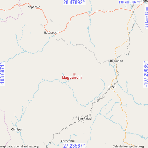
Maguarichi GPS coordinates[2]
27° 51' 32.688" North, 107° 59' 38.292" West
| Map corner | latitude | longitude |
|---|---|---|
| Upper-left | 28.47892°, | -108.6971° |
| Center: | 27.85908°, | -107.99397° |
| Lower-right: | 27.23567°, | -107.29085° |
| Map W x H: | 138.2×138.2 km | = 85.9×85.9mi |
| max Lat: | 32.7° ⇑2.8% North |
| Maguarichi: | 27.85908° |
| min Lat: | ⇓97.2% South 14.53588° |
| min Long | Maguarichi | max Long |
| -117.105° | -107.99397° | -86.73105° |
| W 4.4%⇐ | ⇒95.6% E |
Elevation
Elevation of Maguarichi is 1676 m = 5499 ft, and this is 422.3 m = 1385 ft above average elevation for this country.
| Max E: |
3497 m = 11473 ft | 42.5% |
| Maguarichi | 1676 m 5499 ft | |
| Avg. | 1253.7 m = 4113 ft | |
Min E: |
-1 m = -3 ft | 57.5% |
See also: Mexico elevation on elevation.city.
Geographical zone
Maguarichi is located in North temperate zone (between Tropic of Cancer and the Arctic Circle). Distance of this Northern Tropic circle is 491.7 km =305.5 mi to South.| Distance of | km | miles | from Maguarichi |
|---|---|---|---|
| North Pole | 6909.4 | 4293.3 | to North |
| Arctic Circle | 4303.5 | 2674.1 | to North |
| Tropic Cancer | 491.7 | 305.5 | to South |
| Equator | 3097.6 | 1924.8 | to South |


Nearby cities:
15 places around Maguarichi: (largest is in red/bold)
• Bahuichivo
50.5 km =31.4 mi,  188°
188°
• Basaseachic
44.2 km =27.5 mi,  330°
330°
• Bocoyna
39.8 km =24.7 mi,  92°
92°
• Cajurichic
30.2 km =18.8 mi, 332°
• Cerocahui
62.6 km =38.9 mi, 185°
• Creel
37.3 km =23.2 mi,  108°
108°
• Moris
61.1 km =38 mi,  301°
301°
• Ocampo
52.2 km =32.4 mi,  315°
315°
• San Juanito
40.5 km =25.2 mi,  71°
71°
• San Rafael
41.5 km =25.8 mi,  165°
165°
• Sisoguichi
49.8 km =30.9 mi,  99°
99°
• Tomochic
56.8 km =35.3 mi,  14°
14°
• Témoris
70.7 km =43.9 mi,  203°
203°
• Urique
72.5 km =45 mi, 173°
• Uruachi
21.8 km =13.5 mi,  272°
272°
Sources, notices
• [Note1] Compared only with cities in Mexico existing in our database
• [Src1] Map data: © OpenStreetMap contributors (CC-BY-SA)
• [Src2] Other city data from geonames.org with taken over terms of usage.
• [Src3] Geographical zone / Annual Mean Temperature by Robert A. Rohde @ Wikipedia
