Bejucos geodata
Bejucos (State of Mexico) is a populated place; located in Mexico in America/Mexico_City (GMT-6) time zone. With population of 2,528 people, there are 3507 cities with bigger population in this country. Compared to other cities in Mexico, 69.1% of cities are located further ↑North; 68.8% of cities are located further →East and 67.8% of cities have higher elevation than Bejucos. Note1


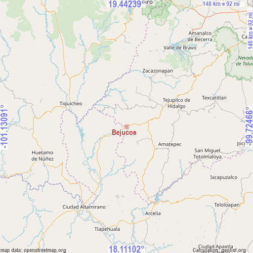
Bejucos GPS coordinates[2]
18° 46' 40.872" North, 100° 25' 40.008" West
| Map corner | latitude | longitude |
|---|---|---|
| Upper-left | 19.44239°, | -101.13091° |
| Center: | 18.77802°, | -100.42778° |
| Lower-right: | 18.11102°, | -99.72466° |
| Map W x H: | 148×148 km | = 92×92mi |
| max Lat: | 32.7° ⇑69.1% North |
| Bejucos: | 18.77802° |
| min Lat: | ⇓30.9% South 14.53588° |
| min Long | Bejucos | max Long |
| -117.105° | -100.42778° | -86.73105° |
| W 31.2%⇐ | ⇒68.8% E |
Elevation
Elevation of Bejucos is 539 m = 1768 ft, and this is 714.7 m = 2345 ft below average elevation for this country.
| Max E: |
3497 m = 11473 ft | 67.8% |
| Avg. | 1253.7 m = 4113 ft | |
| Bejucos | 539 m = 1768 ft | |
Min E: |
-1 m = -3 ft | 32.2% |
See also: Mexico elevation on elevation.city.
Geographical zone
Bejucos is located in North Torrid zone (between Equator and Tropic of Cancer). Distance of this Northern Tropic circle is 518 km =321.9 mi to North.| Distance of | km | miles | from Bejucos |
|---|---|---|---|
| North Pole | 7919.1 | 4920.7 | to North |
| Arctic Circle | 5313.3 | 3301.5 | to North |
| Tropic Cancer | 518 | 321.9 | to North |
| Equator | 2087.9 | 1297.4 | to South |


Nearby cities:
15 places around Bejucos: (largest is in red/bold)
• Balderrama
13.5 km =8.4 mi,  246°
246°
• Cañadas de Nanchititla
9.9 km =6.2 mi,  345°
345°
• Cerro del Campo
21.6 km =13.4 mi,  126°
126°
• El Estanco
22.6 km =14 mi,  52°
52°
• El Rancho
19.1 km =11.9 mi,  124°
124°
• Hermiltepec
24.6 km =15.3 mi,  14°
14°
• Mayaltepec
22.6 km =14 mi,  164°
164°
• Palmar Chico
11.1 km =6.9 mi,  145°
145°
• Palmar Grande
21.9 km =13.6 mi,  175°
175°
• San Francisco de Asís
22.9 km =14.2 mi,  137°
137°
• Tlacocuspan
21.1 km =13.1 mi, 147°
• Trojes
23.4 km =14.5 mi,  43°
43°
• Villa Luvianos
15.7 km =9.8 mi, 10°
• Villa Luvianos
20.9 km =13 mi, 40°
• Zacapuato
22.4 km =13.9 mi,  237°
237°
Sources, notices
• [Note1] Compared only with cities in Mexico existing in our database
• [Src1] Map data: © OpenStreetMap contributors (CC-BY-SA)
• [Src2] Other city data from geonames.org with taken over terms of usage.
• [Src3] Geographical zone / Annual Mean Temperature by Robert A. Rohde @ Wikipedia
