Lo de Lamedo geodata
Lo de Lamedo (Nayarit) is a populated place; located in Mexico in America/Mazatlan (GMT-7) time zone. With population of 1,356 people, there are 6414 cities with bigger population in this country. Compared to other cities in Mexico, 81.6% of cities are located further ↓South; 91.8% of cities are located further →East and 62.7% of cities have higher elevation than Lo de Lamedo. Note1


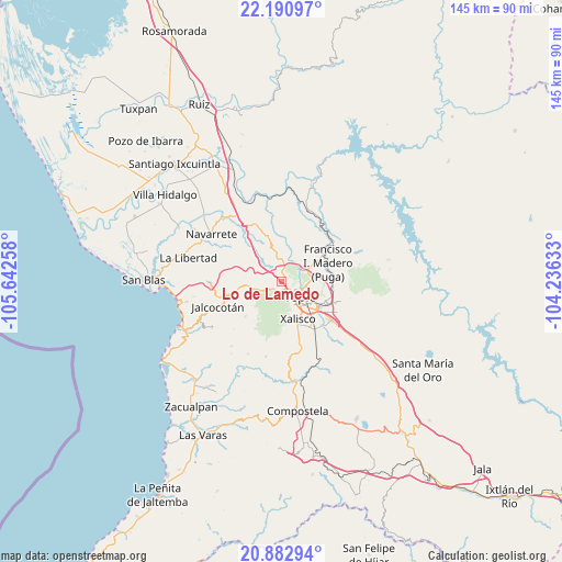
Lo de Lamedo GPS coordinates[2]
21° 32' 18.348" North, 104° 56' 22.02" West
| Map corner | latitude | longitude |
|---|---|---|
| Upper-left | 22.19097°, | -105.64258° |
| Center: | 21.53843°, | -104.93945° |
| Lower-right: | 20.88294°, | -104.23633° |
| Map W x H: | 145.4×145.4 km | = 90.3×90.3mi |
| max Lat: | 32.7° ⇑18.4% North |
| Lo de Lamedo: | 21.53843° |
| min Lat: | ⇓81.6% South 14.53588° |
| min Long | Lo de Lamedo | max Long |
| -117.105° | -104.93945° | -86.73105° |
| W 8.2%⇐ | ⇒91.8% E |
Elevation
Elevation of Lo de Lamedo is 841 m = 2759 ft, and this is 412.7 m = 1354 ft below average elevation for this country.
| Max E: |
3497 m = 11473 ft | 62.7% |
| Avg. | 1253.7 m = 4113 ft | |
| Lo de Lamedo | 841 m = 2759 ft | |
Min E: |
-1 m = -3 ft | 37.3% |
See also: Mexico elevation on elevation.city.
Geographical zone
Lo de Lamedo is located in North Torrid zone (between Equator and Tropic of Cancer). Distance of this Northern Tropic circle is 211.1 km =131.2 mi to North.| Distance of | km | miles | from Lo de Lamedo |
|---|---|---|---|
| North Pole | 7612.2 | 4730 | to North |
| Arctic Circle | 5006.3 | 3110.8 | to North |
| Tropic Cancer | 211.1 | 131.2 | to North |
| Equator | 2394.8 | 1488.1 | to South |


Nearby cities:
15 places around Lo de Lamedo: (largest is in red/bold)
• Bellavista
6.4 km =4 mi,  65°
65°
• Cuarenteño
12.9 km =8 mi,  226°
226°
• El Ahuacate
2.6 km =1.6 mi,  191°
191°
• El Rincón
2.9 km =1.8 mi,  12°
12°
• El Trapichillo
5.9 km =3.7 mi,  310°
310°
• Francisco I. Madero
13.3 km =8.3 mi, 68°
• La Cantera
12.7 km =7.9 mi,  107°
107°
• La Fortuna
2 km =1.2 mi,  323°
323°
• La Yerba
11.5 km =7.1 mi,  260°
260°
• Mora
13.4 km =8.3 mi,  95°
95°
• Pantanal
14.7 km =9.1 mi,  146°
146°
• Puga
13.1 km =8.1 mi, 66°
• San Andrés
8.9 km =5.5 mi,  32°
32°
• Tepic
5.6 km =3.5 mi,  125°
125°
• Xalisco
10.6 km =6.6 mi,  156°
156°
Sources, notices
• [Note1] Compared only with cities in Mexico existing in our database
• [Src1] Map data: © OpenStreetMap contributors (CC-BY-SA)
• [Src2] Other city data from geonames.org with taken over terms of usage.
• [Src3] Geographical zone / Annual Mean Temperature by Robert A. Rohde @ Wikipedia
