La Junta geodata
La Junta (Chihuahua) is a populated place; located in Mexico in America/Chihuahua (GMT-6) time zone. With population of 8,930 people, there are 1064 cities with bigger population in this country. Compared to other cities in Mexico, 97.8% of cities are located further ↓South; 94.7% of cities are located further →East and 77.5% of cities have lower elevation than La Junta. Note1


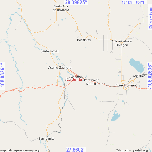
La Junta GPS coordinates[2]
28° 28' 48.108" North, 107° 19' 46.128" West
| Map corner | latitude | longitude |
|---|---|---|
| Upper-left | 29.09625°, | -108.03261° |
| Center: | 28.48003°, | -107.32948° |
| Lower-right: | 27.8602°, | -106.62636° |
| Map W x H: | 137.4×137.4 km | = 85.4×85.4mi |
| max Lat: | 32.7° ⇑2.2% North |
| La Junta: | 28.48003° |
| min Lat: | ⇓97.8% South 14.53588° |
| min Long | La Junta | max Long |
| -117.105° | -107.32948° | -86.73105° |
| W 5.3%⇐ | ⇒94.7% E |
Elevation
Elevation of La Junta is 2078 m = 6818 ft, and this is 824.3 m = 2704 ft above average elevation for this country.
| Max E: |
3497 m = 11473 ft | 22.5% |
| La Junta | 2078 m 6818 ft | |
| Avg. | 1253.7 m = 4113 ft | |
Min E: |
-1 m = -3 ft | 77.5% |
See also: Mexico elevation on elevation.city.
Geographical zone
La Junta is located in North temperate zone (between Tropic of Cancer and the Arctic Circle). Distance of this Northern Tropic circle is 560.8 km =348.5 mi to South.| Distance of | km | miles | from La Junta |
|---|---|---|---|
| North Pole | 6840.4 | 4250.4 | to North |
| Arctic Circle | 4234.5 | 2631.2 | to North |
| Tropic Cancer | 560.8 | 348.5 | to South |
| Equator | 3166.7 | 1967.7 | to South |


Nearby cities:
15 places around La Junta: (largest is in red/bold)
• Adolfo López Mateos
3.2 km =2 mi,  117°
117°
• Bachíniva
32.8 km =20.4 mi,  12°
12°
• Basúchil
8.6 km =5.3 mi,  305°
305°
• Borjas
10.6 km =6.6 mi,  303°
303°
• Campo Número Dos
37.8 km =23.5 mi,  95°
95°
• Cuauhtémoc
46.3 km =28.8 mi, 99°
• Guerrero
16.9 km =10.5 mi, 296°
• Pachera
22.8 km =14.2 mi,  197°
197°
• Paramo
15 km =9.3 mi,  110°
110°
• Pedernales
22.7 km =14.1 mi, 109°
• Ranchos de Santiago
20.2 km =12.6 mi,  134°
134°
• Santo Tomás
32.7 km =20.3 mi, 313°
• Sáenz
3.1 km =1.9 mi, 313°
• Tacuba
20.1 km =12.5 mi,  224°
224°
• Álamos de Cerro Prieto
39.2 km =24.4 mi,  145°
145°
Sources, notices
• [Note1] Compared only with cities in Mexico existing in our database
• [Src1] Map data: © OpenStreetMap contributors (CC-BY-SA)
• [Src2] Other city data from geonames.org with taken over terms of usage.
• [Src3] Geographical zone / Annual Mean Temperature by Robert A. Rohde @ Wikipedia
