Borjas geodata
Borjas (Chihuahua) is a populated place; located in Mexico in America/Chihuahua (GMT-6) time zone. With population of 535 people, there are 15842 cities with bigger population in this country. Compared to other cities in Mexico, 97.8% of cities are located further ↓South; 94.9% of cities are located further →East and 74.3% of cities have lower elevation than Borjas. Note1


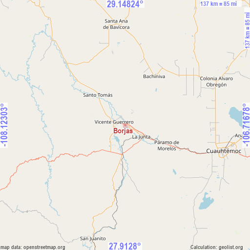
Borjas GPS coordinates[2]
28° 31' 56.388" North, 107° 25' 11.64" West
| Map corner | latitude | longitude |
|---|---|---|
| Upper-left | 29.14824°, | -108.12303° |
| Center: | 28.53233°, | -107.4199° |
| Lower-right: | 27.9128°, | -106.71678° |
| Map W x H: | 137.4×137.4 km | = 85.4×85.4mi |
| max Lat: | 32.7° ⇑2.2% North |
| Borjas: | 28.53233° |
| min Lat: | ⇓97.8% South 14.53588° |
| min Long | Borjas | max Long |
| -117.105° | -107.4199° | -86.73105° |
| W 5.1%⇐ | ⇒94.9% E |
Elevation
Elevation of Borjas is 2018 m = 6621 ft, and this is 764.3 m = 2508 ft above average elevation for this country.
| Max E: |
3497 m = 11473 ft | 25.7% |
| Borjas | 2018 m 6621 ft | |
| Avg. | 1253.7 m = 4113 ft | |
Min E: |
-1 m = -3 ft | 74.3% |
See also: Mexico elevation on elevation.city.
Geographical zone
Borjas is located in North temperate zone (between Tropic of Cancer and the Arctic Circle). Distance of this Northern Tropic circle is 566.6 km =352.1 mi to South.| Distance of | km | miles | from Borjas |
|---|---|---|---|
| North Pole | 6834.6 | 4246.8 | to North |
| Arctic Circle | 4228.7 | 2627.6 | to North |
| Tropic Cancer | 566.6 | 352.1 | to South |
| Equator | 3172.5 | 1971.3 | to South |


Nearby cities:
15 places around Borjas: (largest is in red/bold)
• Adolfo López Mateos
13.8 km =8.6 mi,  121°
121°
• Bachíniva
30.7 km =19.1 mi,  31°
31°
• Basúchil
2 km =1.2 mi, 115°
• Campo Número Dos
47.4 km =29.5 mi,  101°
101°
• Guerrero
6.5 km =4 mi,  286°
286°
• La Junta
10.6 km =6.6 mi, 123°
• Matachí
47.5 km =29.5 mi,  316°
316°
• Pachera
27.7 km =17.2 mi,  175°
175°
• Paramo
25.4 km =15.8 mi, 116°
• Pedernales
33.1 km =20.6 mi,  114°
114°
• Ranchos de Santiago
30.7 km =19.1 mi,  130°
130°
• Santo Tomás
22.4 km =13.9 mi, 318°
• Sáenz
7.6 km =4.7 mi, 119°
• Tacuba
20.8 km =12.9 mi,  194°
194°
• Tomochic
46.2 km =28.7 mi,  244°
244°
Sources, notices
• [Note1] Compared only with cities in Mexico existing in our database
• [Src1] Map data: © OpenStreetMap contributors (CC-BY-SA)
• [Src2] Other city data from geonames.org with taken over terms of usage.
• [Src3] Geographical zone / Annual Mean Temperature by Robert A. Rohde @ Wikipedia
