Ihuatzio geodata
Ihuatzio (Michoacán) is a populated place; located in Mexico in America/Mexico_City (GMT-6) time zone. With population of 3,575 people, there are 2557 cities with bigger population in this country. Compared to other cities in Mexico, 52.7% of cities are located further ↑North; 78.3% of cities are located further →East and 76.5% of cities have lower elevation than Ihuatzio. Note1


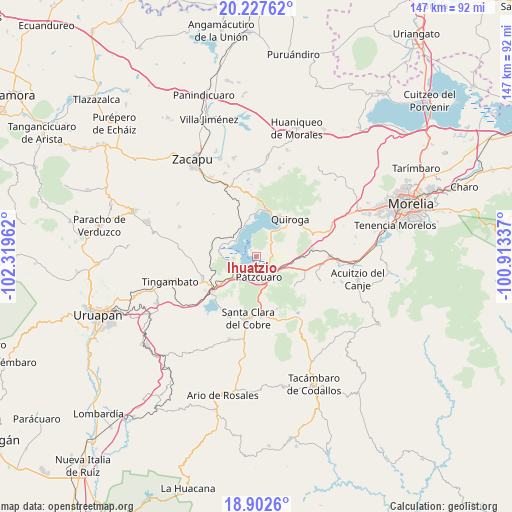
Ihuatzio GPS coordinates[2]
19° 33' 59.292" North, 101° 36' 59.364" West
| Map corner | latitude | longitude |
|---|---|---|
| Upper-left | 20.22762°, | -102.31962° |
| Center: | 19.56647°, | -101.61649° |
| Lower-right: | 18.9026°, | -100.91337° |
| Map W x H: | 147.3×147.3 km | = 91.5×91.5mi |
| max Lat: | 32.7° ⇑52.7% North |
| Ihuatzio: | 19.56647° |
| min Lat: | ⇓47.3% South 14.53588° |
| min Long | Ihuatzio | max Long |
| -117.105° | -101.61649° | -86.73105° |
| W 21.7%⇐ | ⇒78.3% E |
Elevation
Elevation of Ihuatzio is 2057 m = 6749 ft, and this is 803.3 m = 2635 ft above average elevation for this country.
| Max E: |
3497 m = 11473 ft | 23.5% |
| Ihuatzio | 2057 m 6749 ft | |
| Avg. | 1253.7 m = 4113 ft | |
Min E: |
-1 m = -3 ft | 76.5% |
See also: Mexico elevation on elevation.city.
Geographical zone
Ihuatzio is located in North Torrid zone (between Equator and Tropic of Cancer). Distance of this Northern Tropic circle is 430.3 km =267.4 mi to North.| Distance of | km | miles | from Ihuatzio |
|---|---|---|---|
| North Pole | 7831.5 | 4866.3 | to North |
| Arctic Circle | 5225.6 | 3247 | to North |
| Tropic Cancer | 430.3 | 267.4 | to North |
| Equator | 2175.6 | 1351.9 | to South |


Nearby cities:
15 places around Ihuatzio: (largest is in red/bold)
• Arocutín
8.4 km =5.2 mi,  262°
262°
• Colonia Vista Bella (Lomas del Peaje)
8.7 km =5.4 mi,  164°
164°
• Cucuchucho
2.4 km =1.5 mi,  319°
319°
• Huecorio
3.6 km =2.2 mi,  209°
209°
• Janitzio
3.8 km =2.4 mi,  281°
281°
• Jarácuaro
6.5 km =4 mi, 264°
• Joya de los Molinos
8.5 km =5.3 mi,  169°
169°
• Napízaro
8.8 km =5.5 mi,  293°
293°
• Puácuaro
7.3 km =4.5 mi,  303°
303°
• Pátzcuaro
5.7 km =3.5 mi, 171°
• San Miguel Nocutzepo
9.5 km =5.9 mi,  244°
244°
• San Pedro Pareo
6.8 km =4.2 mi, 236°
• Santa Ana Chapitiro
5.9 km =3.7 mi,  220°
220°
• Tzintzuntzán
8 km =5 mi,  30°
30°
• Tócuaro
8.7 km =5.4 mi,  249°
249°
Sources, notices
• [Note1] Compared only with cities in Mexico existing in our database
• [Src1] Map data: © OpenStreetMap contributors (CC-BY-SA)
• [Src2] Other city data from geonames.org with taken over terms of usage.
• [Src3] Geographical zone / Annual Mean Temperature by Robert A. Rohde @ Wikipedia
