Tzintzuntzán geodata
Tzintzuntzán (Michoacán) is a seat of a second-order administrative division; located in Mexico in America/Mexico_City (GMT-6) time zone. With population of 3,534 people, there are 2580 cities with bigger population in this country. Compared to other cities in Mexico, 51.4% of cities are located further ↑North; 78% of cities are located further →East and 76.4% of cities have lower elevation than Tzintzuntzán. Note1


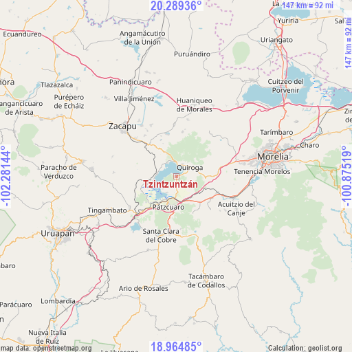
Tzintzuntzán GPS coordinates[2]
19° 37' 42.492" North, 101° 34' 41.916" West
| Map corner | latitude | longitude |
|---|---|---|
| Upper-left | 20.28936°, | -102.28144° |
| Center: | 19.62847°, | -101.57831° |
| Lower-right: | 18.96485°, | -100.87519° |
| Map W x H: | 147.3×147.3 km | = 91.5×91.5mi |
| max Lat: | 32.7° ⇑51.4% North |
| Tzintzuntzán: | 19.62847° |
| min Lat: | ⇓48.6% South 14.53588° |
| min Long | Tzintzuntzán | max Long |
| -117.105° | -101.57831° | -86.73105° |
| W 22%⇐ | ⇒78% E |
Elevation
Elevation of Tzintzuntzán is 2056 m = 6745 ft, and this is 802.3 m = 2632 ft above average elevation for this country.
| Max E: |
3497 m = 11473 ft | 23.6% |
| Tzintzuntzán | 2056 m 6745 ft | |
| Avg. | 1253.7 m = 4113 ft | |
Min E: |
-1 m = -3 ft | 76.4% |
See also: Mexico elevation on elevation.city.
Geographical zone
Tzintzuntzán is located in North Torrid zone (between Equator and Tropic of Cancer). Distance of this Northern Tropic circle is 423.4 km =263.1 mi to North.| Distance of | km | miles | from Tzintzuntzán |
|---|---|---|---|
| North Pole | 7824.6 | 4862 | to North |
| Arctic Circle | 5218.7 | 3242.7 | to North |
| Tropic Cancer | 423.4 | 263.1 | to North |
| Equator | 2182.5 | 1356.1 | to South |


Nearby cities:
15 places around Tzintzuntzán: (largest is in red/bold)
• Cucuchucho
7.5 km =4.7 mi,  227°
227°
• Fontezuelas
14.1 km =8.8 mi,  110°
110°
• Huecorio
11.6 km =7.2 mi,  209°
209°
• Ihuatzio
8 km =5 mi, 210°
• Janitzio
9.9 km =6.2 mi, 231°
• Jarácuaro
12.9 km =8 mi, 234°
• Matugeo
12.3 km =7.6 mi,  341°
341°
• Napízaro
12.5 km =7.8 mi,  254°
254°
• Puácuaro
10.4 km =6.5 mi, 254°
• Pátzcuaro
12.9 km =8 mi,  194°
194°
• Quiroga
7.1 km =4.4 mi,  54°
54°
• San Andrés Ziróndaro
7.3 km =4.5 mi,  308°
308°
• San Jerónimo Purenchecuaro
6.7 km =4.2 mi,  327°
327°
• Santa Ana Chapitiro
13.8 km =8.6 mi, 214°
• Santa Fé de la Laguna
5.5 km =3.4 mi,  26°
26°
Sources, notices
• [Note1] Compared only with cities in Mexico existing in our database
• [Src1] Map data: © OpenStreetMap contributors (CC-BY-SA)
• [Src2] Other city data from geonames.org with taken over terms of usage.
• [Src3] Geographical zone / Annual Mean Temperature by Robert A. Rohde @ Wikipedia
