Huejotitán geodata
Huejotitán (Chihuahua) is a seat of a second-order administrative division; located in Mexico in America/Chihuahua (GMT-6) time zone. With population of 243 people, there are 16879 cities with bigger population in this country. Compared to other cities in Mexico, 96.4% of cities are located further ↓South; 93.9% of cities are located further →East and 56.9% of cities have lower elevation than Huejotitán. Note1


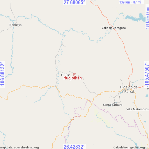
Huejotitán GPS coordinates[2]
27° 3' 22.428" North, 106° 10' 41.484" West
| Map corner | latitude | longitude |
|---|---|---|
| Upper-left | 27.68065°, | -106.88132° |
| Center: | 27.05623°, | -106.17819° |
| Lower-right: | 26.42832°, | -105.47507° |
| Map W x H: | 139.2×139.2 km | = 86.5×86.5mi |
| max Lat: | 32.7° ⇑3.6% North |
| Huejotitán: | 27.05623° |
| min Lat: | ⇓96.4% South 14.53588° |
| min Long | Huejotitán | max Long |
| -117.105° | -106.17819° | -86.73105° |
| W 6.1%⇐ | ⇒93.9% E |
Elevation
Elevation of Huejotitán is 1654 m = 5427 ft, and this is 400.3 m = 1313 ft above average elevation for this country.
| Max E: |
3497 m = 11473 ft | 43.1% |
| Huejotitán | 1654 m 5427 ft | |
| Avg. | 1253.7 m = 4113 ft | |
Min E: |
-1 m = -3 ft | 56.9% |
See also: Mexico elevation on elevation.city.
Geographical zone
Huejotitán is located in North temperate zone (between Tropic of Cancer and the Arctic Circle). Distance of this Northern Tropic circle is 402.5 km =250.1 mi to South.| Distance of | km | miles | from Huejotitán |
|---|---|---|---|
| North Pole | 6998.7 | 4348.8 | to North |
| Arctic Circle | 4392.8 | 2729.6 | to North |
| Tropic Cancer | 402.5 | 250.1 | to South |
| Equator | 3008.4 | 1869.3 | to South |


Nearby cities:
15 places around Huejotitán: (largest is in red/bold)
• Balleza
20.6 km =12.8 mi,  235°
235°
• Ejido El Vergel
68.1 km =42.3 mi,  197°
197°
• El Oro
39.1 km =24.3 mi,  123°
123°
• El Tule
8.7 km =5.4 mi,  268°
268°
• Mariano Balleza
20.2 km =12.6 mi, 235°
• Matamoros
67.3 km =41.8 mi, 119°
• Nonoava
72 km =44.7 mi,  310°
310°
• Parral
52.6 km =32.7 mi,  105°
105°
• Pueblito de Allende
84.6 km =52.6 mi,  94°
94°
• Santa Bárbara
45.2 km =28.1 mi,  128°
128°
• Santa Gertrudis (La Hacienda)
91.6 km =56.9 mi,  28°
28°
• Talamantes
75.2 km =46.7 mi,  102°
102°
• Valle de Allende
79 km =49.1 mi, 99°
• Valle de Zaragoza
57.1 km =35.5 mi,  39°
39°
• Valle del Rosario
31.4 km =19.5 mi,  338°
338°
Sources, notices
• [Note1] Compared only with cities in Mexico existing in our database
• [Src1] Map data: © OpenStreetMap contributors (CC-BY-SA)
• [Src2] Other city data from geonames.org with taken over terms of usage.
• [Src3] Geographical zone / Annual Mean Temperature by Robert A. Rohde @ Wikipedia
