Ejido El Vergel geodata
Ejido El Vergel (Chihuahua) is a populated place; located in Mexico in America/Chihuahua (GMT-6) time zone. With population of 2,008 people, there are 4332 cities with bigger population in this country. Compared to other cities in Mexico, 95.8% of cities are located further ↓South; 94% of cities are located further →East and 97.8% of cities have lower elevation than Ejido El Vergel. Note1


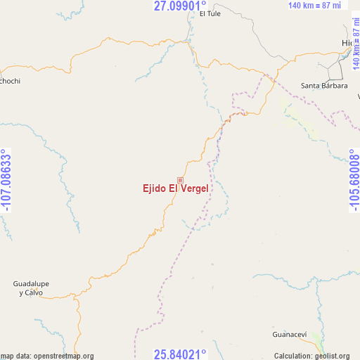
Ejido El Vergel GPS coordinates[2]
26° 28' 16.788" North, 106° 22' 59.52" West
| Map corner | latitude | longitude |
|---|---|---|
| Upper-left | 27.09901°, | -107.08633° |
| Center: | 26.47133°, | -106.3832° |
| Lower-right: | 25.84021°, | -105.68008° |
| Map W x H: | 140×140 km | = 87×87mi |
| max Lat: | 32.7° ⇑4.2% North |
| Ejido El Vergel: | 26.47133° |
| min Lat: | ⇓95.8% South 14.53588° |
| min Long | Ejido El Vergel | max Long |
| -117.105° | -106.3832° | -86.73105° |
| W 6%⇐ | ⇒94% E |
Elevation
Elevation of Ejido El Vergel is 2733 m = 8967 ft, and this is 1479.3 m = 4853 ft above average elevation for this country.
| Max E: |
3497 m = 11473 ft | 2.2% |
| Ejido El Vergel | 2733 m 8967 ft | |
| Avg. | 1253.7 m = 4113 ft | |
Min E: |
-1 m = -3 ft | 97.8% |
See also: Mexico elevation on elevation.city.
Geographical zone
Ejido El Vergel is located in North temperate zone (between Tropic of Cancer and the Arctic Circle). Distance of this Northern Tropic circle is 337.4 km =209.7 mi to South.| Distance of | km | miles | from Ejido El Vergel |
|---|---|---|---|
| North Pole | 7063.7 | 4389.2 | to North |
| Arctic Circle | 4457.8 | 2769.9 | to North |
| Tropic Cancer | 337.4 | 209.7 | to South |
| Equator | 2943.3 | 1828.9 | to South |


Nearby cities:
15 places around Ejido El Vergel: (largest is in red/bold)
• Arroyo de Lajas
59.4 km =36.9 mi,  171°
171°
• Balleza
53.5 km =33.2 mi,  3°
3°
• El Oro
68.7 km =42.7 mi,  50°
50°
• El Tule
65.8 km =40.9 mi,  10°
10°
• Guachochi
78.9 km =49 mi,  299°
299°
• Guadalupe y Calvo
71.6 km =44.5 mi,  233°
233°
• Guanaceví
73.6 km =45.7 mi,  144°
144°
• Huejotitán
68.1 km =42.3 mi,  17°
17°
• Las Yerbitas [Aserradero]
58.8 km =36.5 mi,  222°
222°
• Mariano Balleza
53.8 km =33.4 mi, 3°
• Matamoros
85.7 km =53.3 mi,  67°
67°
• San Pedro de Chinatú (Ranchería San Pedro)
39.6 km =24.6 mi, 216°
• Santa Bárbara
67.1 km =41.7 mi,  56°
56°
• Turuachi
49.5 km =30.8 mi, 220°
• Villa Ocampo
87.3 km =54.2 mi,  92°
92°
Sources, notices
• [Note1] Compared only with cities in Mexico existing in our database
• [Src1] Map data: © OpenStreetMap contributors (CC-BY-SA)
• [Src2] Other city data from geonames.org with taken over terms of usage.
• [Src3] Geographical zone / Annual Mean Temperature by Robert A. Rohde @ Wikipedia
