Mixtlán geodata
Mixtlán (Jalisco) is a seat of a second-order administrative division; located in Mexico in America/Mexico_City (GMT-6) time zone. With population of 1,538 people, there are 5618 cities with bigger population in this country. Compared to other cities in Mexico, 66.5% of cities are located further ↓South; 90.8% of cities are located further →East and 53.2% of cities have lower elevation than Mixtlán. Note1


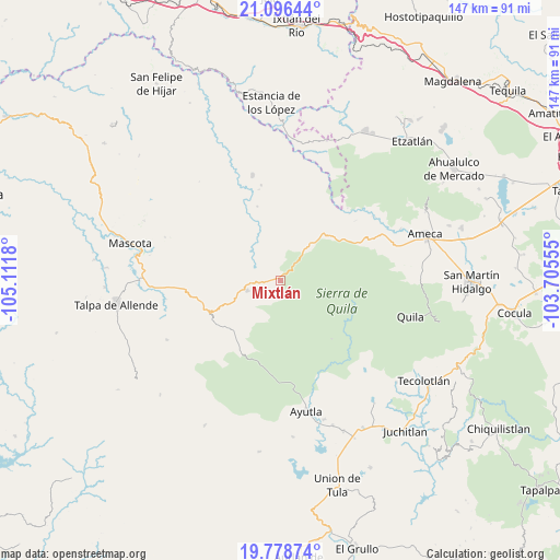
Mixtlán GPS coordinates[2]
20° 26' 20.4" North, 104° 24' 31.212" West
| Map corner | latitude | longitude |
|---|---|---|
| Upper-left | 21.09644°, | -105.1118° |
| Center: | 20.439°, | -104.40867° |
| Lower-right: | 19.77874°, | -103.70555° |
| Map W x H: | 146.5×146.5 km | = 91×91mi |
| max Lat: | 32.7° ⇑33.5% North |
| Mixtlán: | 20.439° |
| min Lat: | ⇓66.5% South 14.53588° |
| min Long | Mixtlán | max Long |
| -117.105° | -104.40867° | -86.73105° |
| W 9.2%⇐ | ⇒90.8% E |
Elevation
Elevation of Mixtlán is 1544 m = 5066 ft, and this is 290.3 m = 952 ft above average elevation for this country.
| Max E: |
3497 m = 11473 ft | 46.8% |
| Mixtlán | 1544 m 5066 ft | |
| Avg. | 1253.7 m = 4113 ft | |
Min E: |
-1 m = -3 ft | 53.2% |
See also: Mexico elevation on elevation.city.
Geographical zone
Mixtlán is located in North Torrid zone (between Equator and Tropic of Cancer). Distance of this Northern Tropic circle is 333.3 km =207.1 mi to North.| Distance of | km | miles | from Mixtlán |
|---|---|---|---|
| North Pole | 7734.5 | 4806 | to North |
| Arctic Circle | 5128.6 | 3186.8 | to North |
| Tropic Cancer | 333.3 | 207.1 | to North |
| Equator | 2272.6 | 1412.1 | to South |


Nearby cities:
15 places around Mixtlán: (largest is in red/bold)
• Atengo
25.6 km =15.9 mi,  135°
135°
• Atenguillo
9.3 km =5.8 mi,  253°
253°
• Ayutla
35.1 km =21.8 mi,  168°
168°
• Cuautla
26.4 km =16.4 mi,  179°
179°
• El Salto
15.1 km =9.4 mi,  219°
219°
• Guachinango
15.6 km =9.7 mi,  10°
10°
• Jayamitla
29.3 km =18.2 mi,  54°
54°
• Juanacatlán
31.9 km =19.8 mi,  149°
149°
• La Laja
20.5 km =12.7 mi,  323°
323°
• La Villita
29.6 km =18.4 mi,  56°
56°
• Los Volcanes
18.7 km =11.6 mi,  226°
226°
• San Nicolás
34 km =21.1 mi,  66°
66°
• Soyatlán del Oro
20.3 km =12.6 mi, 138°
• Tepantla
29.1 km =18.1 mi,  163°
163°
• Texcalame
35.2 km =21.9 mi,  87°
87°
Sources, notices
• [Note1] Compared only with cities in Mexico existing in our database
• [Src1] Map data: © OpenStreetMap contributors (CC-BY-SA)
• [Src2] Other city data from geonames.org with taken over terms of usage.
• [Src3] Geographical zone / Annual Mean Temperature by Robert A. Rohde @ Wikipedia
