Cananea geodata
Cananea (Sonora) is a seat of a second-order administrative division; located in Mexico in America/Hermosillo (GMT-7) time zone. With population of 31,560 people, there are 319 cities with bigger population in this country. Compared to other cities in Mexico, 99% of cities are located further ↓South; 98.3% of cities are located further →East and 55.4% of cities have lower elevation than Cananea. Note1


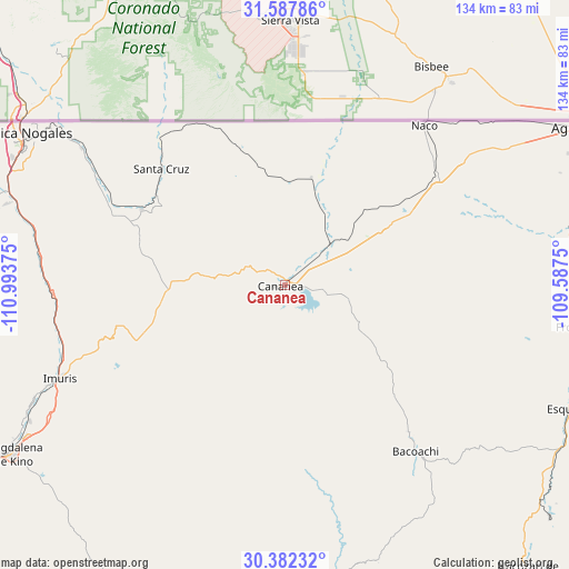
Cananea GPS coordinates[2]
30° 59' 13.164" North, 110° 17' 26.232" West
| Map corner | latitude | longitude |
|---|---|---|
| Upper-left | 31.58786°, | -110.99375° |
| Center: | 30.98699°, | -110.29062° |
| Lower-right: | 30.38232°, | -109.5875° |
| Map W x H: | 134×134 km | = 83.3×83.3mi |
| max Lat: | 32.7° ⇑1% North |
| Cananea: | 30.98699° |
| min Lat: | ⇓99% South 14.53588° |
| min Long | Cananea | max Long |
| -117.105° | -110.29062° | -86.73105° |
| W 1.7%⇐ | ⇒98.3% E |
Elevation
Elevation of Cananea is 1599 m = 5246 ft, and this is 345.3 m = 1133 ft above average elevation for this country.
| Max E: |
3497 m = 11473 ft | 44.6% |
| Cananea | 1599 m 5246 ft | |
| Avg. | 1253.7 m = 4113 ft | |
Min E: |
-1 m = -3 ft | 55.4% |
See also: Mexico elevation on elevation.city.
Geographical zone
Cananea is located in North temperate zone (between Tropic of Cancer and the Arctic Circle). Distance of this Northern Tropic circle is 839.5 km =521.6 mi to South.| Distance of | km | miles | from Cananea |
|---|---|---|---|
| North Pole | 6561.6 | 4077.2 | to North |
| Arctic Circle | 3955.7 | 2458 | to North |
| Tropic Cancer | 839.5 | 521.6 | to South |
| Equator | 3445.4 | 2140.9 | to South |


Nearby cities:
15 places around Cananea: (largest is in red/bold)
• Bacoachi
50.1 km =31.1 mi,  142°
142°
• Campo Carretero
58.8 km =36.5 mi,  245°
245°
• Centro de Readaptación Social Nuevo
68.1 km =42.3 mi,  288°
288°
• Cíbuta
58.5 km =36.4 mi,  278°
278°
• El Crucero
60.4 km =37.5 mi, 246°
• El Tasicuri
71 km =44.1 mi,  239°
239°
• Francisco Miguel Cárdenas Valdez (Mascareñas)
57.6 km =35.8 mi,  303°
303°
• Fronteras
70.4 km =43.7 mi,  98°
98°
• Imuris
57.4 km =35.7 mi, 247°
• La Estación
60.2 km =37.4 mi, 247°
• La Mesa
67.9 km =42.2 mi, 286°
• Miguel Hidalgo
37.9 km =23.5 mi, 297°
• Naco
50 km =31.1 mi,  40°
40°
• San Ignacio
68.4 km =42.5 mi, 241°
• Santa Cruz
40 km =24.9 mi,  313°
313°
In other languages:
- In Spanish: Cananea, Heroica Ciudad de Cananea
- In Russian: Кананеа
- In Chinese: 卡納內阿
Sources, notices
• [Note1] Compared only with cities in Mexico existing in our database
• [Src1] Map data: © OpenStreetMap contributors (CC-BY-SA)
• [Src2] Other city data from geonames.org with taken over terms of usage.
• [Src3] Geographical zone / Annual Mean Temperature by Robert A. Rohde @ Wikipedia
