Bacoachi geodata
Bacoachi (Sonora) is a seat of a second-order administrative division; located in Mexico in America/Hermosillo (GMT-7) time zone. With population of 1,090 people, there are 7984 cities with bigger population in this country. Compared to other cities in Mexico, 98.7% of cities are located further ↓South; 98.1% of cities are located further →East and 59% of cities have higher elevation than Bacoachi. Note1


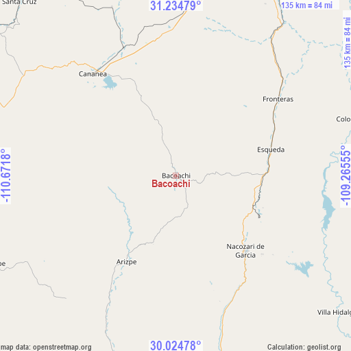
Bacoachi GPS coordinates[2]
30° 37' 54.048" North, 109° 58' 7.212" West
| Map corner | latitude | longitude |
|---|---|---|
| Upper-left | 31.23479°, | -110.6718° |
| Center: | 30.63168°, | -109.96867° |
| Lower-right: | 30.02478°, | -109.26555° |
| Map W x H: | 134.5×134.5 km | = 83.6×83.6mi |
| max Lat: | 32.7° ⇑1.3% North |
| Bacoachi: | 30.63168° |
| min Lat: | ⇓98.7% South 14.53588° |
| min Long | Bacoachi | max Long |
| -117.105° | -109.96867° | -86.73105° |
| W 1.9%⇐ | ⇒98.1% E |
Elevation
Elevation of Bacoachi is 1053 m = 3455 ft, and this is 200.7 m = 658 ft below average elevation for this country.
| Max E: |
3497 m = 11473 ft | 59% |
| Avg. | 1253.7 m = 4113 ft | |
| Bacoachi | 1053 m = 3455 ft | |
Min E: |
-1 m = -3 ft | 41% |
See also: Mexico elevation on elevation.city.
Geographical zone
Bacoachi is located in North temperate zone (between Tropic of Cancer and the Arctic Circle). Distance of this Northern Tropic circle is 800 km =497.1 mi to South.| Distance of | km | miles | from Bacoachi |
|---|---|---|---|
| North Pole | 6601.1 | 4101.7 | to North |
| Arctic Circle | 3995.3 | 2482.6 | to North |
| Tropic Cancer | 800 | 497.1 | to South |
| Equator | 3405.9 | 2116.3 | to South |


Nearby cities:
15 places around Bacoachi: (largest is in red/bold)
• Arizpe
37.9 km =23.5 mi,  210°
210°
• Banámichi
73.4 km =45.6 mi,  198°
198°
• Cananea
50.1 km =31.1 mi,  322°
322°
• Cucurpe
78.2 km =48.6 mi,  244°
244°
• Cumpas
73 km =45.4 mi,  165°
165°
• Esqueda
37.7 km =23.4 mi,  74°
74°
• Fronteras
49 km =30.4 mi,  52°
52°
• Huépac
83.5 km =51.9 mi, 196°
• Jécori
80.4 km =50 mi,  163°
163°
• Los Hoyos
59.2 km =36.8 mi, 162°
• Naco
77.3 km =48 mi,  1°
1°
• Nacozari Viejo
39.9 km =24.8 mi,  130°
130°
• Nacozari de García
39.2 km =24.4 mi,  136°
136°
• Ojo de Agua
68.8 km =42.8 mi, 165°
• Villa Hidalgo
81.1 km =50.4 mi, 130°
Sources, notices
• [Note1] Compared only with cities in Mexico existing in our database
• [Src1] Map data: © OpenStreetMap contributors (CC-BY-SA)
• [Src2] Other city data from geonames.org with taken over terms of usage.
• [Src3] Geographical zone / Annual Mean Temperature by Robert A. Rohde @ Wikipedia
