Melchor Ocampo geodata
Melchor Ocampo (Michoacán) is a populated place; located in Mexico in America/Mexico_City (GMT-6) time zone. With population of 657 people, there are 13209 cities with bigger population in this country. Compared to other cities in Mexico, 64.1% of cities are located further ↑North; 75.3% of cities are located further →East and 65.7% of cities have higher elevation than Melchor Ocampo. Note1


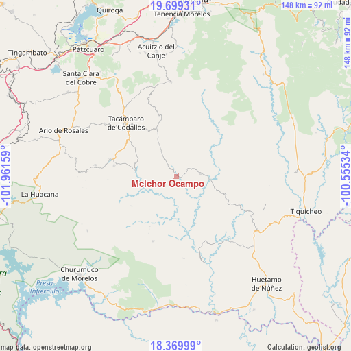
Melchor Ocampo GPS coordinates[2]
19° 2' 9.528" North, 101° 15' 30.456" West
| Map corner | latitude | longitude |
|---|---|---|
| Upper-left | 19.69931°, | -101.96159° |
| Center: | 19.03598°, | -101.25846° |
| Lower-right: | 18.36999°, | -100.55534° |
| Map W x H: | 147.8×147.8 km | = 91.8×91.8mi |
| max Lat: | 32.7° ⇑64.1% North |
| Melchor Ocampo: | 19.03598° |
| min Lat: | ⇓35.9% South 14.53588° |
| min Long | Melchor Ocampo | max Long |
| -117.105° | -101.25846° | -86.73105° |
| W 24.7%⇐ | ⇒75.3% E |
Elevation
Elevation of Melchor Ocampo is 652 m = 2139 ft, and this is 601.7 m = 1974 ft below average elevation for this country.
| Max E: |
3497 m = 11473 ft | 65.7% |
| Avg. | 1253.7 m = 4113 ft | |
| Melchor Ocampo | 652 m = 2139 ft | |
Min E: |
-1 m = -3 ft | 34.3% |
See also: Mexico elevation on elevation.city.
Geographical zone
Melchor Ocampo is located in North Torrid zone (between Equator and Tropic of Cancer). Distance of this Northern Tropic circle is 489.3 km =304 mi to North.| Distance of | km | miles | from Melchor Ocampo |
|---|---|---|---|
| North Pole | 7890.5 | 4902.9 | to North |
| Arctic Circle | 5284.6 | 3283.7 | to North |
| Tropic Cancer | 489.3 | 304 | to North |
| Equator | 2116.6 | 1315.2 | to South |


Nearby cities:
15 places around Melchor Ocampo: (largest is in red/bold)
• Canícuaro
28.7 km =17.8 mi,  319°
319°
• Carácuaro
14.2 km =8.8 mi,  97°
97°
• Chupio
25.3 km =15.7 mi,  308°
308°
• La Ermita (Nueva Jerusalén)
26.4 km =16.4 mi,  279°
279°
• La Huerta
27.7 km =17.2 mi, 284°
• La Loma
23.5 km =14.6 mi, 314°
• Las Hoyas Altas
27.8 km =17.3 mi, 321°
• Las Joyas (El Poblado)
26.2 km =16.3 mi, 316°
• Nocupétaro
10.2 km =6.3 mi,  85°
85°
• Ojo de Agua de Chupio
20.6 km =12.8 mi,  303°
303°
• Pedernales
25 km =15.5 mi, 297°
• Petembo
26.5 km =16.5 mi,  291°
291°
• Puruarán
28.5 km =17.7 mi, 283°
• San Miguel Tamácuaro
29.9 km =18.6 mi, 320°
• Turicato
17 km =10.6 mi, 276°
Sources, notices
• [Note1] Compared only with cities in Mexico existing in our database
• [Src1] Map data: © OpenStreetMap contributors (CC-BY-SA)
• [Src2] Other city data from geonames.org with taken over terms of usage.
• [Src3] Geographical zone / Annual Mean Temperature by Robert A. Rohde @ Wikipedia
