Ojo de Agua del Refugio geodata
Ojo de Agua del Refugio (Guanajuato) is a populated place; located in Mexico in America/Mexico_City (GMT-6) time zone. With population of 1,796 people, there are 4846 cities with bigger population in this country. Compared to other cities in Mexico, 76.6% of cities are located further ↓South; 67.5% of cities are located further →East and 81.9% of cities have lower elevation than Ojo de Agua del Refugio. Note1
Current local time in Ojo de Agua del Refugio:
08:27 AM, WednesdayDifference from your time zone: hours


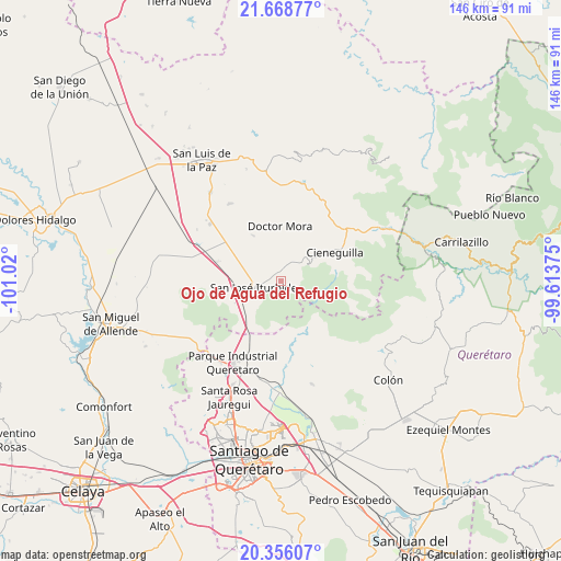
Ojo de Agua del Refugio GPS coordinates[2]
21° 0' 49.896" North, 100° 19' 0.732" West
| Map corner | latitude | longitude |
|---|---|---|
| Upper-left | 21.66877°, | -101.02° |
| Center: | 21.01386°, | -100.31687° |
| Lower-right: | 20.35607°, | -99.61375° |
| Map W x H: | 146×146 km | = 90.7×90.7mi |
| max Lat: | 32.7° ⇑23.4% North |
| Ojo de Agua del Refugio: | 21.01386° |
| min Lat: | ⇓76.6% South 14.53588° |
| min Long | Ojo de Agua del | max Long |
| -117.105° | -100.31687° | -86.73105° |
| W 32.5%⇐ | ⇒67.5% E |
Elevation
Elevation of Ojo de Agua del Refugio is 2188 m = 7178 ft, and this is 934.3 m = 3065 ft above average elevation for this country.
| Max E: |
3497 m = 11473 ft | 18.1% |
| Ojo de Agua del Refugio | 2188 m 7178 ft | |
| Avg. | 1253.7 m = 4113 ft | |
Min E: |
-1 m = -3 ft | 81.9% |
See also: Mexico elevation on elevation.city.
Geographical zone
Ojo de Agua del Refugio is located in North Torrid zone (between Equator and Tropic of Cancer). Distance of this Northern Tropic circle is 269.4 km =167.4 mi to North.| Distance of | km | miles | from Ojo de Agua del Refugio |
|---|---|---|---|
| North Pole | 7670.5 | 4766.2 | to North |
| Arctic Circle | 5064.7 | 3147.1 | to North |
| Tropic Cancer | 269.4 | 167.4 | to North |
| Equator | 2336.5 | 1451.8 | to South |


Nearby cities:
15 places around Ojo de Agua del Refugio: (largest is in red/bold)
• Carbajal
6.6 km =4.1 mi,  45°
45°
• El Capulín
3 km =1.9 mi,  349°
349°
• El Pinito
8.5 km =5.3 mi,  258°
258°
• El Zapote
1.9 km =1.2 mi,  120°
120°
• La Ciénega
3.3 km =2.1 mi,  340°
340°
• La Redonda
7.6 km =4.7 mi,  359°
359°
• La Reforma
8.8 km =5.5 mi,  299°
299°
• La Yerbabuena
4.3 km =2.7 mi, 300°
• Las Tuzas
3.5 km =2.2 mi,  135°
135°
• Miranda
7.3 km =4.5 mi, 347°
• Morisquilla
9.3 km =5.8 mi, 339°
• Prados del Rosario
7.9 km =4.9 mi,  276°
276°
• Rincón de Cano
9 km =5.6 mi,  59°
59°
• San José Iturbide
7.1 km =4.4 mi, 258°
• Santa Anita
1.8 km =1.1 mi,  286°
286°
Sources, notices
• [Note1] Compared only with cities in Mexico existing in our database
• [Src1] Map data: © OpenStreetMap contributors (CC-BY-SA)
• [Src2] Other city data from geonames.org with taken over terms of usage.
• [Src3] Geographical zone / Annual Mean Temperature by Robert A. Rohde @ Wikipedia
