Miranda geodata
Miranda (Guanajuato) is a populated place; located in Mexico in America/Mexico_City (GMT-6) time zone. With population of 593 people, there are 14492 cities with bigger population in this country. Compared to other cities in Mexico, 77.6% of cities are located further ↓South; 67.7% of cities are located further →East and 78.4% of cities have lower elevation than Miranda. Note1


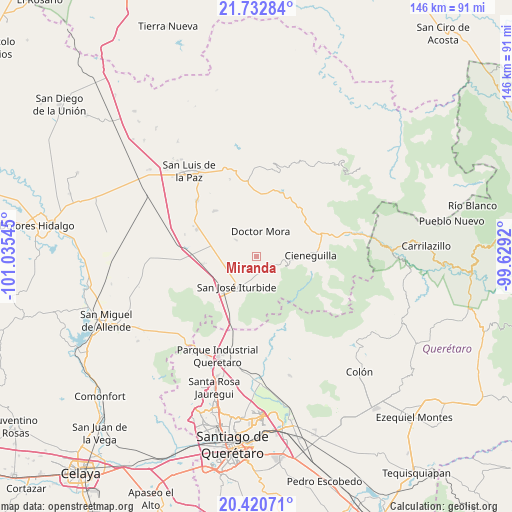
Miranda GPS coordinates[2]
21° 4' 41.592" North, 100° 19' 56.352" West
| Map corner | latitude | longitude |
|---|---|---|
| Upper-left | 21.73284°, | -101.03545° |
| Center: | 21.07822°, | -100.33232° |
| Lower-right: | 20.42071°, | -99.6292° |
| Map W x H: | 145.9×145.9 km | = 90.7×90.7mi |
| max Lat: | 32.7° ⇑22.4% North |
| Miranda: | 21.07822° |
| min Lat: | ⇓77.6% South 14.53588° |
| min Long | Miranda | max Long |
| -117.105° | -100.33232° | -86.73105° |
| W 32.3%⇐ | ⇒67.7% E |
Elevation
Elevation of Miranda is 2098 m = 6883 ft, and this is 844.3 m = 2770 ft above average elevation for this country.
| Max E: |
3497 m = 11473 ft | 21.6% |
| Miranda | 2098 m 6883 ft | |
| Avg. | 1253.7 m = 4113 ft | |
Min E: |
-1 m = -3 ft | 78.4% |
See also: Mexico elevation on elevation.city.
Geographical zone
Miranda is located in North Torrid zone (between Equator and Tropic of Cancer). Distance of this Northern Tropic circle is 262.2 km =162.9 mi to North.| Distance of | km | miles | from Miranda |
|---|---|---|---|
| North Pole | 7663.4 | 4761.8 | to North |
| Arctic Circle | 5057.5 | 3142.6 | to North |
| Tropic Cancer | 262.2 | 162.9 | to North |
| Equator | 2343.7 | 1456.3 | to South |


Nearby cities:
15 places around Miranda: (largest is in red/bold)
• Carbajal
6.8 km =4.2 mi,  111°
111°
• Derramadero de Charcas
4.2 km =2.6 mi,  36°
36°
• Doctor Mora
7.3 km =4.5 mi,  10°
10°
• El Capulín
4.3 km =2.7 mi,  165°
165°
• El Zapote
8.7 km =5.4 mi,  158°
158°
• La Ciénega
4.1 km =2.5 mi, 173°
• La Noria
7 km =4.3 mi,  310°
310°
• La Redonda
1.6 km =1 mi,  74°
74°
• La Reforma
6.7 km =4.2 mi,  245°
245°
• La Yerbabuena
5.4 km =3.4 mi,  203°
203°
• Morisquilla
2.3 km =1.4 mi, 313°
• Ojo de Agua del Refugio
7.3 km =4.5 mi, 167°
• Pueblo Nuevo
8.1 km =5 mi,  286°
286°
• San Rafael
6.5 km =4 mi,  338°
338°
• Santa Anita
6.6 km =4.1 mi,  180°
180°
Sources, notices
• [Note1] Compared only with cities in Mexico existing in our database
• [Src1] Map data: © OpenStreetMap contributors (CC-BY-SA)
• [Src2] Other city data from geonames.org with taken over terms of usage.
• [Src3] Geographical zone / Annual Mean Temperature by Robert A. Rohde @ Wikipedia
