Loma de Buenavista geodata
Loma de Buenavista (Guanajuato) is a populated place; located in Mexico in America/Mexico_City (GMT-6) time zone. With population of 854 people, there are 10250 cities with bigger population in this country. Compared to other cities in Mexico, 78.9% of cities are located further ↓South; 67.9% of cities are located further →East and 78.1% of cities have lower elevation than Loma de Buenavista. Note1


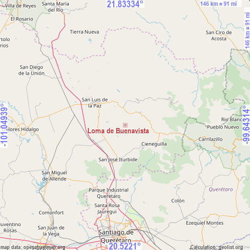
Loma de Buenavista GPS coordinates[2]
21° 10' 45.012" North, 100° 20' 46.536" West
| Map corner | latitude | longitude |
|---|---|---|
| Upper-left | 21.83334°, | -101.04939° |
| Center: | 21.17917°, | -100.34626° |
| Lower-right: | 20.5221°, | -99.64314° |
| Map W x H: | 145.8×145.8 km | = 90.6×90.6mi |
| max Lat: | 32.7° ⇑21.1% North |
| Loma de Buenavista: | 21.17917° |
| min Lat: | ⇓78.9% South 14.53588° |
| min Long | Loma de Buenavi | max Long |
| -117.105° | -100.34626° | -86.73105° |
| W 32.1%⇐ | ⇒67.9% E |
Elevation
Elevation of Loma de Buenavista is 2091 m = 6860 ft, and this is 837.3 m = 2747 ft above average elevation for this country.
| Max E: |
3497 m = 11473 ft | 21.9% |
| Loma de Buenavista | 2091 m 6860 ft | |
| Avg. | 1253.7 m = 4113 ft | |
Min E: |
-1 m = -3 ft | 78.1% |
See also: Mexico elevation on elevation.city.
Geographical zone
Loma de Buenavista is located in North Torrid zone (between Equator and Tropic of Cancer). Distance of this Northern Tropic circle is 251 km =156 mi to North.| Distance of | km | miles | from Loma de Buenavista |
|---|---|---|---|
| North Pole | 7652.2 | 4754.9 | to North |
| Arctic Circle | 5046.3 | 3135.6 | to North |
| Tropic Cancer | 251 | 156 | to North |
| Equator | 2354.9 | 1463.3 | to South |


Nearby cities:
15 places around Loma de Buenavista: (largest is in red/bold)
• Carmen
7.4 km =4.6 mi,  21°
21°
• Cieneguilla
10.7 km =6.6 mi,  44°
44°
• Derramadero de Charcas
8.8 km =5.5 mi,  153°
153°
• Doctor Mora
4.9 km =3 mi, 145°
• El Varal (La Merced)
10.2 km =6.3 mi,  279°
279°
• Ex-Hacienda de Ortega (Ejido Ortega)
12.2 km =7.6 mi,  330°
330°
• La Noria
7.7 km =4.8 mi,  210°
210°
• La Redonda
11.2 km =7 mi,  164°
164°
• Los Linderos
12.6 km =7.8 mi,  67°
67°
• Miranda
11.3 km =7 mi,  172°
172°
• Misión de Arnedo
11.3 km =7 mi,  59°
59°
• Morisquilla
9.7 km =6 mi,  181°
181°
• Pueblo Nuevo
10.9 km =6.8 mi,  215°
215°
• San Rafael
5.2 km =3.2 mi,  189°
189°
• Vagui
2 km =1.2 mi, 165°
Sources, notices
• [Note1] Compared only with cities in Mexico existing in our database
• [Src1] Map data: © OpenStreetMap contributors (CC-BY-SA)
• [Src2] Other city data from geonames.org with taken over terms of usage.
• [Src3] Geographical zone / Annual Mean Temperature by Robert A. Rohde @ Wikipedia
