Los Cerritos geodata
Los Cerritos (Querétaro) is a populated place; located in Mexico in America/Mexico_City (GMT-6) time zone. With population of 2,202 people, there are 3987 cities with bigger population in this country. Compared to other cities in Mexico, 69.1% of cities are located further ↓South; 64.7% of cities are located further →East and 69.6% of cities have lower elevation than Los Cerritos. Note1


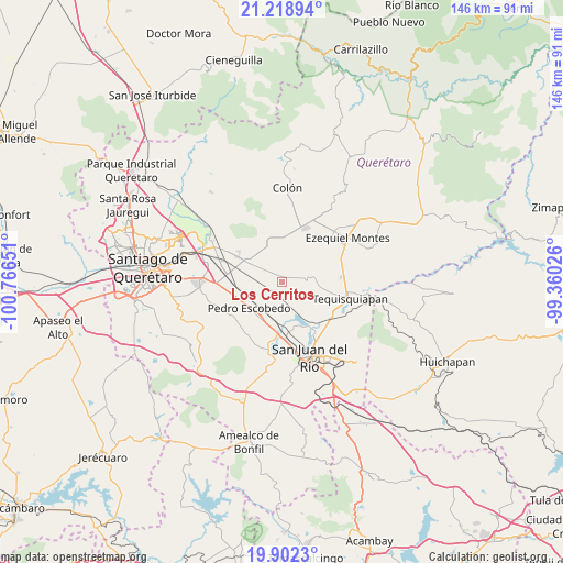
Los Cerritos GPS coordinates[2]
20° 33' 43.344" North, 100° 3' 48.168" West
| Map corner | latitude | longitude |
|---|---|---|
| Upper-left | 21.21894°, | -100.76651° |
| Center: | 20.56204°, | -100.06338° |
| Lower-right: | 19.9023°, | -99.36026° |
| Map W x H: | 146.4×146.4 km | = 91×91mi |
| max Lat: | 32.7° ⇑30.9% North |
| Los Cerritos: | 20.56204° |
| min Lat: | ⇓69.1% South 14.53588° |
| min Long | Los Cerritos | max Long |
| -117.105° | -100.06338° | -86.73105° |
| W 35.3%⇐ | ⇒64.7% E |
Elevation
Elevation of Los Cerritos is 1917 m = 6289 ft, and this is 663.3 m = 2176 ft above average elevation for this country.
| Max E: |
3497 m = 11473 ft | 30.4% |
| Los Cerritos | 1917 m 6289 ft | |
| Avg. | 1253.7 m = 4113 ft | |
Min E: |
-1 m = -3 ft | 69.6% |
See also: Mexico elevation on elevation.city.
Geographical zone
Los Cerritos is located in North Torrid zone (between Equator and Tropic of Cancer). Distance of this Northern Tropic circle is 319.6 km =198.6 mi to North.| Distance of | km | miles | from Los Cerritos |
|---|---|---|---|
| North Pole | 7720.8 | 4797.5 | to North |
| Arctic Circle | 5114.9 | 3178.3 | to North |
| Tropic Cancer | 319.6 | 198.6 | to North |
| Equator | 2286.3 | 1420.6 | to South |


Nearby cities:
15 places around Los Cerritos: (largest is in red/bold)
• El Blanco
6.8 km =4.2 mi,  323°
323°
• El Tejocote
7.1 km =4.4 mi,  25°
25°
• Fuentezuelas
8.5 km =5.3 mi,  94°
94°
• Guadalupe Septién
6.5 km =4 mi,  233°
233°
• Ignacio Pérez
6.7 km =4.2 mi, 228°
• La Fuente
3 km =1.9 mi,  110°
110°
• La Laja
8.7 km =5.4 mi,  80°
80°
• La Valla
7.9 km =4.9 mi,  151°
151°
• Las Cenizas
5 km =3.1 mi,  347°
347°
• Los Álvarez
8.1 km =5 mi,  261°
261°
• México Lindo
4.7 km =2.9 mi,  293°
293°
• Noria Nueva
6.4 km =4 mi, 264°
• Purísima de Cubos (La Purísima)
7.1 km =4.4 mi,  306°
306°
• San Clemente
5.7 km =3.5 mi,  202°
202°
• San Francisco
7.7 km =4.8 mi, 286°
Sources, notices
• [Note1] Compared only with cities in Mexico existing in our database
• [Src1] Map data: © OpenStreetMap contributors (CC-BY-SA)
• [Src2] Other city data from geonames.org with taken over terms of usage.
• [Src3] Geographical zone / Annual Mean Temperature by Robert A. Rohde @ Wikipedia
