La Candelaria geodata
La Candelaria (Veracruz) is a populated place; located in Mexico in America/Mexico_City (GMT-6) time zone. With population of 523 people, there are 16139 cities with bigger population in this country. Compared to other cities in Mexico, 72.8% of cities are located further ↓South; 59.5% of cities are located further ←West and 68.7% of cities have higher elevation than La Candelaria. Note1


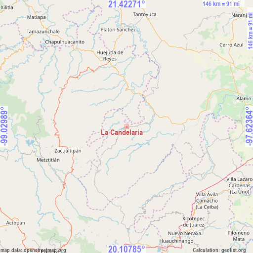
La Candelaria GPS coordinates[2]
20° 46' 0.156" North, 98° 19' 36.336" West
| Map corner | latitude | longitude |
|---|---|---|
| Upper-left | 21.42271°, | -99.02989° |
| Center: | 20.76671°, | -98.32676° |
| Lower-right: | 20.10785°, | -97.62364° |
| Map W x H: | 146.2×146.2 km | = 90.8×90.8mi |
| max Lat: | 32.7° ⇑27.2% North |
| La Candelaria: | 20.76671° |
| min Lat: | ⇓72.8% South 14.53588° |
| min Long | La Candelaria | max Long |
| -117.105° | -98.32676° | -86.73105° |
| W 59.5%⇐ | ⇒40.5% E |
Elevation
Elevation of La Candelaria is 487 m = 1598 ft, and this is 766.7 m = 2515 ft below average elevation for this country.
| Max E: |
3497 m = 11473 ft | 68.7% |
| Avg. | 1253.7 m = 4113 ft | |
| La Candelaria | 487 m = 1598 ft | |
Min E: |
-1 m = -3 ft | 31.3% |
See also: Mexico elevation on elevation.city.
Geographical zone
La Candelaria is located in North Torrid zone (between Equator and Tropic of Cancer). Distance of this Northern Tropic circle is 296.9 km =184.5 mi to North.| Distance of | km | miles | from La Candelaria |
|---|---|---|---|
| North Pole | 7698 | 4783.3 | to North |
| Arctic Circle | 5092.1 | 3164.1 | to North |
| Tropic Cancer | 296.9 | 184.5 | to North |
| Equator | 2309 | 1434.7 | to South |


Nearby cities:
15 places around La Candelaria: (largest is in red/bold)
• Acanoa
6.9 km =4.3 mi,  59°
59°
• Arnatepec
8.9 km =5.5 mi,  288°
288°
• Atlalco
7.2 km =4.5 mi,  36°
36°
• Chahuatlán
7.2 km =4.5 mi,  284°
284°
• El Mamey
2.9 km =1.8 mi,  82°
82°
• Huitztipan
8.6 km =5.3 mi,  334°
334°
• José María Pino Suárez
7.6 km =4.7 mi,  246°
246°
• Otlatzintla
8.3 km =5.2 mi, 80°
• Pocantla
8.7 km =5.4 mi,  9°
9°
• Tetzacual
6.1 km =3.8 mi, 83°
• Tlatlazoquico
6.8 km =4.2 mi, 332°
• Xochiatipan de Castillo
8.7 km =5.4 mi,  29°
29°
• Xococapa
5.4 km =3.4 mi, 331°
• Xocotitla
6 km =3.7 mi, 31°
• Zontecomatlán de López y Fuentes
1.8 km =1.1 mi, 254°
Sources, notices
• [Note1] Compared only with cities in Mexico existing in our database
• [Src1] Map data: © OpenStreetMap contributors (CC-BY-SA)
• [Src2] Other city data from geonames.org with taken over terms of usage.
• [Src3] Geographical zone / Annual Mean Temperature by Robert A. Rohde @ Wikipedia
