Arnatepec geodata
Arnatepec (Veracruz) is a populated place; located in Mexico in America/Mexico_City (GMT-6) time zone. With population of 845 people, there are 10356 cities with bigger population in this country. Compared to other cities in Mexico, 73.2% of cities are located further ↓South; 58.5% of cities are located further ←West and 63.3% of cities have higher elevation than Arnatepec. Note1


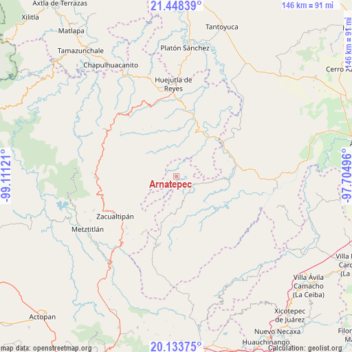
Arnatepec GPS coordinates[2]
20° 47' 33" North, 98° 24' 29.088" West
| Map corner | latitude | longitude |
|---|---|---|
| Upper-left | 21.44839°, | -99.11121° |
| Center: | 20.7925°, | -98.40808° |
| Lower-right: | 20.13375°, | -97.70496° |
| Map W x H: | 146.2×146.2 km | = 90.8×90.8mi |
| max Lat: | 32.7° ⇑26.8% North |
| Arnatepec: | 20.7925° |
| min Lat: | ⇓73.2% South 14.53588° |
| min Long | Arnatepec | max Long |
| -117.105° | -98.40808° | -86.73105° |
| W 58.5%⇐ | ⇒41.5% E |
Elevation
Elevation of Arnatepec is 796 m = 2612 ft, and this is 457.7 m = 1502 ft below average elevation for this country.
| Max E: |
3497 m = 11473 ft | 63.3% |
| Avg. | 1253.7 m = 4113 ft | |
| Arnatepec | 796 m = 2612 ft | |
Min E: |
-1 m = -3 ft | 36.7% |
See also: Mexico elevation on elevation.city.
Geographical zone
Arnatepec is located in North Torrid zone (between Equator and Tropic of Cancer). Distance of this Northern Tropic circle is 294 km =182.7 mi to North.| Distance of | km | miles | from Arnatepec |
|---|---|---|---|
| North Pole | 7695.2 | 4781.6 | to North |
| Arctic Circle | 5089.3 | 3162.3 | to North |
| Tropic Cancer | 294 | 182.7 | to North |
| Equator | 2311.9 | 1436.5 | to South |


Nearby cities:
15 places around Arnatepec: (largest is in red/bold)
• Aguacatitla
7.9 km =4.9 mi,  344°
344°
• Atempa
4.2 km =2.6 mi,  191°
191°
• Chahuatlán
1.9 km =1.2 mi,  124°
124°
• Coacoaco
4.9 km =3 mi,  322°
322°
• Huitztipan
6.8 km =4.2 mi,  43°
43°
• Ilamatlán
3.9 km =2.4 mi,  249°
249°
• José María Pino Suárez
6 km =3.7 mi,  165°
165°
• La Candelaria
8.9 km =5.5 mi,  108°
108°
• San Gregorio
3.6 km =2.2 mi,  30°
30°
• Santa Cruz
1.3 km =0.8 mi,  289°
289°
• Tecapa
8.7 km =5.4 mi,  220°
220°
• Tlatlazoquico
6.2 km =3.9 mi,  59°
59°
• Xalacahuantla
8.8 km =5.5 mi,  265°
265°
• Xococapa
6.2 km =3.9 mi,  72°
72°
• Zontecomatlán de López y Fuentes
7.5 km =4.7 mi, 116°
Sources, notices
• [Note1] Compared only with cities in Mexico existing in our database
• [Src1] Map data: © OpenStreetMap contributors (CC-BY-SA)
• [Src2] Other city data from geonames.org with taken over terms of usage.
• [Src3] Geographical zone / Annual Mean Temperature by Robert A. Rohde @ Wikipedia
