Zontecomatlán de López y Fuentes geodata
Zontecomatlán de López y Fuentes (Veracruz) is a seat of a second-order administrative division; located in Mexico in America/Mexico_City (GMT-6) time zone. With population of 672 people, there are 12920 cities with bigger population in this country. Compared to other cities in Mexico, 72.7% of cities are located further ↓South; 59.4% of cities are located further ←West and 68.3% of cities have higher elevation than Zontecomatlán de López y Fuentes. Note1
Current local time in Zontecomatlán de López y Fuentes:
10:01 AM, MondayDifference from your time zone: hours


Zontecomatlán de López y Fuentes GPS coordinates[2]
20° 45' 44.496" North, 98° 20' 35.484" West
| Map corner | latitude | longitude |
|---|---|---|
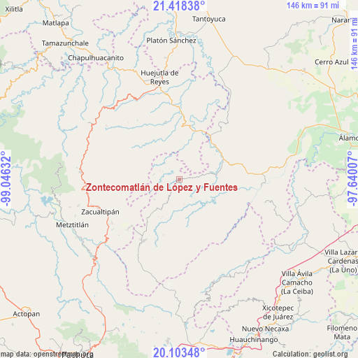
| Upper-left | 21.41838°, | -99.04632° |
| Center: | 20.76236°, | -98.34319° |
| Lower-right: | 20.10348°, | -97.64007° |
| Map W x H: | 146.2×146.2 km | = 90.8×90.8mi |
| max Lat: | 32.7° ⇑27.3% North |
| Zontecomatlán de López y Fuentes: | 20.76236° |
| min Lat: | ⇓72.7% South 14.53588° |
| min Long | Zontecomatlán | max Long |
| -117.105° | -98.34319° | -86.73105° |
| W 59.4%⇐ | ⇒40.6% E |
Elevation
Elevation of Zontecomatlán de López y Fuentes is 509 m = 1670 ft, and this is 744.7 m = 2443 ft below average elevation for this country.
| Max E: |
3497 m = 11473 ft | 68.3% |
| Avg. | 1253.7 m = 4113 ft | |
| Zontecomatlán de López y Fuentes | 509 m = 1670 ft | |
Min E: |
-1 m = -3 ft | 31.7% |
See also: Mexico elevation on elevation.city.
Geographical zone
Zontecomatlán de López y Fuentes is located in North Torrid zone (between Equator and Tropic of Cancer). Distance of this Northern Tropic circle is 297.4 km =184.8 mi to North.| Distance of | km | miles | from Zontecomatlán de López y Fuentes |
|---|---|---|---|
| North Pole | 7698.5 | 4783.6 | to North |
| Arctic Circle | 5092.6 | 3164.4 | to North |
| Tropic Cancer | 297.4 | 184.8 | to North |
| Equator | 2308.6 | 1434.5 | to South |


Nearby cities:
15 places around Zontecomatlán de López y Fuentes: (largest is in red/bold)
• Acanoa
8.6 km =5.3 mi,  62°
62°
• Arnatepec
7.5 km =4.7 mi,  296°
296°
• Atempa
7.6 km =4.7 mi,  263°
263°
• Atlalco
8.6 km =5.3 mi,  43°
43°
• Chahuatlán
5.7 km =3.5 mi,  293°
293°
• El Mamey
4.6 km =2.9 mi,  79°
79°
• Huitztipan
8.5 km =5.3 mi,  345°
345°
• José María Pino Suárez
5.8 km =3.6 mi,  244°
244°
• La Candelaria
1.8 km =1.1 mi,  74°
74°
• San Gregorio
8.1 km =5 mi,  322°
322°
• Santa Cruz
8.8 km =5.5 mi, 295°
• Tetzacual
7.8 km =4.8 mi, 81°
• Tlatlazoquico
6.6 km =4.1 mi, 348°
• Xococapa
5.3 km =3.3 mi, 350°
• Xocotitla
7.4 km =4.6 mi, 40°
Sources, notices
• [Note1] Compared only with cities in Mexico existing in our database
• [Src1] Map data: © OpenStreetMap contributors (CC-BY-SA)
• [Src2] Other city data from geonames.org with taken over terms of usage.
• [Src3] Geographical zone / Annual Mean Temperature by Robert A. Rohde @ Wikipedia
