San Felipe de Jesús geodata
San Felipe de Jesús (Sonora) is a seat of a second-order administrative division; located in Mexico in America/Hermosillo (GMT-7) time zone. With population of 392 people, there are 16845 cities with bigger population in this country. Compared to other cities in Mexico, 98.4% of cities are located further ↓South; 98.3% of cities are located further →East and 66.3% of cities have higher elevation than San Felipe de Jesús. Note1


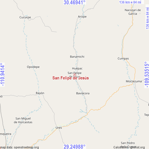
San Felipe de Jesús GPS coordinates[2]
29° 51' 41.436" North, 110° 14' 17.772" West
| Map corner | latitude | longitude |
|---|---|---|
| Upper-left | 30.46941°, | -110.9414° |
| Center: | 29.86151°, | -110.23827° |
| Lower-right: | 29.24988°, | -109.53515° |
| Map W x H: | 135.6×135.6 km | = 84.3×84.3mi |
| max Lat: | 32.7° ⇑1.6% North |
| San Felipe de Jesús: | 29.86151° |
| min Lat: | ⇓98.4% South 14.53588° |
| min Long | San Felipe de J | max Long |
| -117.105° | -110.23827° | -86.73105° |
| W 1.7%⇐ | ⇒98.3% E |
Elevation
Elevation of San Felipe de Jesús is 623 m = 2044 ft, and this is 630.7 m = 2069 ft below average elevation for this country.
| Max E: |
3497 m = 11473 ft | 66.3% |
| Avg. | 1253.7 m = 4113 ft | |
| San Felipe de Jesús | 623 m = 2044 ft | |
Min E: |
-1 m = -3 ft | 33.7% |
See also: Mexico elevation on elevation.city.
Geographical zone
San Felipe de Jesús is located in North temperate zone (between Tropic of Cancer and the Arctic Circle). Distance of this Northern Tropic circle is 714.4 km =443.9 mi to South.| Distance of | km | miles | from San Felipe de Jesús |
|---|---|---|---|
| North Pole | 6686.8 | 4155 | to North |
| Arctic Circle | 4080.9 | 2535.8 | to North |
| Tropic Cancer | 714.4 | 443.9 | to South |
| Equator | 3320.3 | 2063.1 | to South |


Nearby cities:
15 places around San Felipe de Jesús: (largest is in red/bold)
• Aconchi
4.1 km =2.5 mi,  161°
161°
• Arizpe
53.3 km =33.1 mi,  7°
7°
• Banámichi
16.4 km =10.2 mi, 7°
• Baviácora
18 km =11.2 mi, 156°
• Cumpas
46.5 km =28.9 mi,  71°
71°
• Guadalupe
56.9 km =35.4 mi,  201°
201°
• Huépac
6 km =3.7 mi,  23°
23°
• Jécori
49.1 km =30.5 mi,  80°
80°
• La Estancia
8 km =5 mi, 159°
• Los Hoyos
52.8 km =32.8 mi,  56°
56°
• Moctezuma
54.2 km =33.7 mi,  96°
96°
• Ojo de Agua
47.3 km =29.4 mi, 66°
• Opodepe
38.4 km =23.9 mi,  280°
280°
• Rayón
35.9 km =22.3 mi,  242°
242°
• Ures
50.4 km =31.3 mi, 196°
Sources, notices
• [Note1] Compared only with cities in Mexico existing in our database
• [Src1] Map data: © OpenStreetMap contributors (CC-BY-SA)
• [Src2] Other city data from geonames.org with taken over terms of usage.
• [Src3] Geographical zone / Annual Mean Temperature by Robert A. Rohde @ Wikipedia
