Tenango geodata
Tenango (Chiapas) is a populated place; located in Mexico in America/Mexico_City (GMT-6) time zone. With population of 4,436 people, there are 2072 cities with bigger population in this country. Compared to other cities in Mexico, 90.2% of cities are located further ↑North; 93.6% of cities are located further ←West and 52.9% of cities have higher elevation than Tenango. Note1


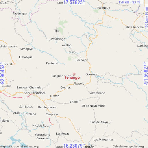
Tenango GPS coordinates[2]
16° 54' 16.992" North, 92° 15' 41.004" West
| Map corner | latitude | longitude |
|---|---|---|
| Upper-left | 17.57625°, | -92.96452° |
| Center: | 16.90472°, | -92.26139° |
| Lower-right: | 16.23079°, | -91.55827° |
| Map W x H: | 149.6×149.6 km | = 93×93mi |
| max Lat: | 32.7° ⇑90.2% North |
| Tenango: | 16.90472° |
| min Lat: | ⇓9.8% South 14.53588° |
| min Long | Tenango | max Long |
| -117.105° | -92.26139° | -86.73105° |
| W 93.6%⇐ | ⇒6.4% E |
Elevation
Elevation of Tenango is 1297 m = 4255 ft, and this is 43.3 m = 142 ft above average elevation for this country.
| Max E: |
3497 m = 11473 ft | 52.9% |
| Tenango | 1297 m 4255 ft | |
| Avg. | 1253.7 m = 4113 ft | |
Min E: |
-1 m = -3 ft | 47.1% |
See also: Mexico elevation on elevation.city.
Geographical zone
Tenango is located in North Torrid zone (between Equator and Tropic of Cancer). Distance of this Northern Tropic circle is 726.3 km =451.3 mi to North.| Distance of | km | miles | from Tenango |
|---|---|---|---|
| North Pole | 8127.4 | 5050.1 | to North |
| Arctic Circle | 5521.5 | 3430.9 | to North |
| Tropic Cancer | 726.3 | 451.3 | to North |
| Equator | 1879.6 | 1167.9 | to South |


Nearby cities:
15 places around Tenango: (largest is in red/bold)
• Abasolo
10.4 km =6.5 mi,  152°
152°
• Altamirano
12.1 km =7.5 mi,  101°
101°
• Chacté
10.1 km =6.3 mi,  291°
291°
• Chojchow
10.4 km =6.5 mi,  272°
272°
• Cruztón
10.6 km =6.6 mi,  230°
230°
• El Corralito
9.3 km =5.8 mi,  175°
175°
• El Tzay
7.1 km =4.4 mi, 229°
• Guaquitepec
8.9 km =5.5 mi,  341°
341°
• La Frontera Uno
3.9 km =2.4 mi,  320°
320°
• La Virginia
9.7 km =6 mi,  108°
108°
• Mequeja
6.5 km =4 mi,  24°
24°
• Palomar 2
10.7 km =6.6 mi, 145°
• San Antonio Bulujib
10.9 km =6.8 mi, 339°
• San Juan Cancuc
11.6 km =7.2 mi,  263°
263°
• San Marcos
7.9 km =4.9 mi,  41°
41°
Sources, notices
• [Note1] Compared only with cities in Mexico existing in our database
• [Src1] Map data: © OpenStreetMap contributors (CC-BY-SA)
• [Src2] Other city data from geonames.org with taken over terms of usage.
• [Src3] Geographical zone / Annual Mean Temperature by Robert A. Rohde @ Wikipedia
