Palo Seco (El Gato) geodata
Palo Seco (El Gato) (San Luis Potosí) is a populated place; located in Mexico in America/Mexico_City (GMT-6) time zone. With population of 1,291 people, there are 6718 cities with bigger population in this country. Compared to other cities in Mexico, 86% of cities are located further ↓South; 66.4% of cities are located further →East and 57.5% of cities have higher elevation than Palo Seco (El Gato). Note1


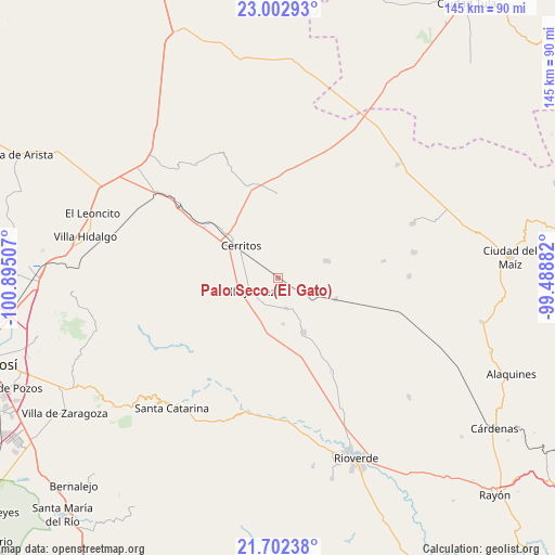
Palo Seco (El Gato) GPS coordinates[2]
22° 21' 15.012" North, 100° 11' 30.984" West
| Map corner | latitude | longitude |
|---|---|---|
| Upper-left | 23.00293°, | -100.89507° |
| Center: | 22.35417°, | -100.19194° |
| Lower-right: | 21.70238°, | -99.48882° |
| Map W x H: | 144.6×144.6 km | = 89.9×89.9mi |
| max Lat: | 32.7° ⇑14% North |
| Palo Seco (El Gato): | 22.35417° |
| min Lat: | ⇓86% South 14.53588° |
| min Long | Palo Seco (El G | max Long |
| -117.105° | -100.19194° | -86.73105° |
| W 33.6%⇐ | ⇒66.4% E |
Elevation
Elevation of Palo Seco (El Gato) is 1114 m = 3655 ft, and this is 139.7 m = 458 ft below average elevation for this country.
| Max E: |
3497 m = 11473 ft | 57.5% |
| Avg. | 1253.7 m = 4113 ft | |
| Palo Seco (El Gato) | 1114 m = 3655 ft | |
Min E: |
-1 m = -3 ft | 42.5% |
See also: Mexico elevation on elevation.city.
Geographical zone
Palo Seco (El Gato) is located in North Torrid zone (between Equator and Tropic of Cancer). Distance of this Northern Tropic circle is 120.4 km =74.8 mi to North.| Distance of | km | miles | from Palo Seco (El Gato) |
|---|---|---|---|
| North Pole | 7521.5 | 4673.6 | to North |
| Arctic Circle | 4915.6 | 3054.4 | to North |
| Tropic Cancer | 120.4 | 74.8 | to North |
| Equator | 2485.6 | 1544.5 | to South |


Nearby cities:
15 places around Palo Seco (El Gato): (largest is in red/bold)
• Buenavista
27.6 km =17.1 mi,  10°
10°
• Cerritos
12.6 km =7.8 mi,  310°
310°
• Derramaderos
19.8 km =12.3 mi,  334°
334°
• El Quelital
21.7 km =13.5 mi,  359°
359°
• Granjenal
13.4 km =8.3 mi,  71°
71°
• Joya de Luna
25.3 km =15.7 mi,  290°
290°
• La Hincada
35 km =21.7 mi, 14°
• Ojo de Agua
14.3 km =8.9 mi,  45°
45°
• Pastora
28 km =17.4 mi,  150°
150°
• Progreso
15.5 km =9.6 mi, 154°
• Puerta del Río
14.6 km =9.1 mi,  209°
209°
• San Bartolo
16.2 km =10.1 mi,  110°
110°
• Santo Domingo
8.2 km =5.1 mi,  163°
163°
• Tanque de los Ángeles
28 km =17.4 mi,  80°
80°
• Villa Juárez
8.3 km =5.2 mi,  248°
248°
Sources, notices
• [Note1] Compared only with cities in Mexico existing in our database
• [Src1] Map data: © OpenStreetMap contributors (CC-BY-SA)
• [Src2] Other city data from geonames.org with taken over terms of usage.
• [Src3] Geographical zone / Annual Mean Temperature by Robert A. Rohde @ Wikipedia
