El Camarón geodata
El Camarón (Oaxaca) is a populated place; located in Mexico in America/Mexico_City (GMT-6) time zone. With population of 975 people, there are 8909 cities with bigger population in this country. Compared to other cities in Mexico, 77.4% of cities are located further ↑North; 81.4% of cities are located further ←West and 84.5% of cities have higher elevation than El Camarón. Note1


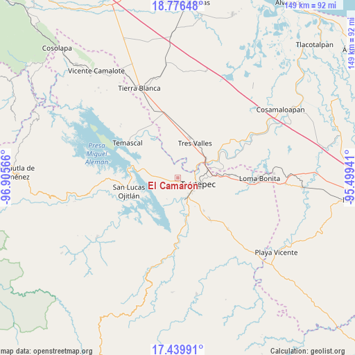
El Camarón GPS coordinates[2]
18° 6' 34.092" North, 96° 12' 9.108" West
| Map corner | latitude | longitude |
|---|---|---|
| Upper-left | 18.77648°, | -96.90566° |
| Center: | 18.10947°, | -96.20253° |
| Lower-right: | 17.43991°, | -95.49941° |
| Map W x H: | 148.6×148.6 km | = 92.3×92.3mi |
| max Lat: | 32.7° ⇑77.4% North |
| El Camarón: | 18.10947° |
| min Lat: | ⇓22.6% South 14.53588° |
| min Long | El Camarón | max Long |
| -117.105° | -96.20253° | -86.73105° |
| W 81.4%⇐ | ⇒18.6% E |
Elevation
Elevation of El Camarón is 48 m = 157 ft, and this is 1205.7 m = 3956 ft below average elevation for this country.
| Max E: |
3497 m = 11473 ft | 84.5% |
| Avg. | 1253.7 m = 4113 ft | |
| El Camarón | 48 m = 157 ft | |
Min E: |
-1 m = -3 ft | 15.5% |
See also: Mexico elevation on elevation.city.
Geographical zone
El Camarón is located in North Torrid zone (between Equator and Tropic of Cancer). Distance of this Northern Tropic circle is 592.3 km =368 mi to North.| Distance of | km | miles | from El Camarón |
|---|---|---|---|
| North Pole | 7993.5 | 4966.9 | to North |
| Arctic Circle | 5387.6 | 3347.7 | to North |
| Tropic Cancer | 592.3 | 368 | to North |
| Equator | 2013.6 | 1251.2 | to South |


Nearby cities:
15 places around El Camarón: (largest is in red/bold)
• Buenos Aires el Apompo
10 km =6.2 mi,  292°
292°
• Camelia Roja
9 km =5.6 mi,  183°
183°
• El Porvenir
5.3 km =3.3 mi,  343°
343°
• Las Peñitas
7.5 km =4.7 mi,  63°
63°
• Macín Chico
8.6 km =5.3 mi,  237°
237°
• Mata de Caña
12.5 km =7.8 mi,  133°
133°
• Mazín Grande
11.3 km =7 mi,  273°
273°
• Papaloapan
12.8 km =8 mi, 63°
• Paso Canoa
11.4 km =7.1 mi,  199°
199°
• San Bartolo
10.2 km =6.3 mi,  100°
100°
• San Isidro
4.7 km =2.9 mi,  15°
15°
• Santa Ursula
11.9 km =7.4 mi, 196°
• Sebastopol
9 km =5.6 mi,  159°
159°
• Soledad Macín Chico
5.9 km =3.7 mi, 198°
• Tuxtepec
8.5 km =5.3 mi,  106°
106°
Sources, notices
• [Note1] Compared only with cities in Mexico existing in our database
• [Src1] Map data: © OpenStreetMap contributors (CC-BY-SA)
• [Src2] Other city data from geonames.org with taken over terms of usage.
• [Src3] Geographical zone / Annual Mean Temperature by Robert A. Rohde @ Wikipedia
