El Progreso geodata
El Progreso (Puebla) is a populated place; located in Mexico in America/Mexico_City (GMT-6) time zone. With population of 1,305 people, there are 6645 cities with bigger population in this country. Compared to other cities in Mexico, 57.4% of cities are located further ↓South; 70.9% of cities are located further ←West and 67.7% of cities have higher elevation than El Progreso. Note1


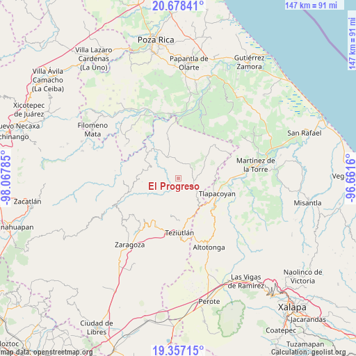
El Progreso GPS coordinates[2]
20° 1' 9.012" North, 97° 21' 52.992" West
| Map corner | latitude | longitude |
|---|---|---|
| Upper-left | 20.67841°, | -98.06785° |
| Center: | 20.01917°, | -97.36472° |
| Lower-right: | 19.35715°, | -96.6616° |
| Map W x H: | 146.9×146.9 km | = 91.3×91.3mi |
| max Lat: | 32.7° ⇑42.6% North |
| El Progreso: | 20.01917° |
| min Lat: | ⇓57.4% South 14.53588° |
| min Long | El Progreso | max Long |
| -117.105° | -97.36472° | -86.73105° |
| W 70.9%⇐ | ⇒29.1% E |
Elevation
Elevation of El Progreso is 544 m = 1785 ft, and this is 709.7 m = 2328 ft below average elevation for this country.
| Max E: |
3497 m = 11473 ft | 67.7% |
| Avg. | 1253.7 m = 4113 ft | |
| El Progreso | 544 m = 1785 ft | |
Min E: |
-1 m = -3 ft | 32.3% |
See also: Mexico elevation on elevation.city.
Geographical zone
El Progreso is located in North Torrid zone (between Equator and Tropic of Cancer). Distance of this Northern Tropic circle is 380 km =236.1 mi to North.| Distance of | km | miles | from El Progreso |
|---|---|---|---|
| North Pole | 7781.1 | 4834.9 | to North |
| Arctic Circle | 5175.3 | 3215.8 | to North |
| Tropic Cancer | 380 | 236.1 | to North |
| Equator | 2225.9 | 1383.1 | to South |


Nearby cities:
15 places around El Progreso: (largest is in red/bold)
• Amatetel
9.3 km =5.8 mi,  137°
137°
• Atehuetzin
11.5 km =7.1 mi,  93°
93°
• Ayotoxco de Guerrero
9.7 km =6 mi,  331°
331°
• Conta
12.2 km =7.6 mi,  146°
146°
• Cuauhtapanaloyan
11.4 km =7.1 mi,  301°
301°
• Gachupinate
11.4 km =7.1 mi,  339°
339°
• Hueytamalco
11.8 km =7.3 mi, 137°
• Limontitán Grande
9.5 km =5.9 mi,  110°
110°
• Mazatepec
5.7 km =3.5 mi,  267°
267°
• Nectepec
8.1 km =5 mi,  279°
279°
• Pepexta
10.4 km =6.5 mi, 283°
• San Antonio Metzonapa
4 km =2.5 mi, 336°
• Santiago Yancuictlalpan
12.2 km =7.6 mi,  292°
292°
• Xalpantzingo
11.2 km =7 mi, 273°
• Zacatipan
7.7 km =4.8 mi, 286°
Sources, notices
• [Note1] Compared only with cities in Mexico existing in our database
• [Src1] Map data: © OpenStreetMap contributors (CC-BY-SA)
• [Src2] Other city data from geonames.org with taken over terms of usage.
• [Src3] Geographical zone / Annual Mean Temperature by Robert A. Rohde @ Wikipedia
