Carmen Serdán geodata
Carmen Serdán (Puebla) is a populated place; located in Mexico in America/Mexico_City (GMT-6) time zone. With population of 1,234 people, there are 7034 cities with bigger population in this country. Compared to other cities in Mexico, 64.1% of cities are located further ↑North; 65.9% of cities are located further ←West and 84.7% of cities have lower elevation than Carmen Serdán. Note1


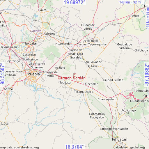
Carmen Serdán GPS coordinates[2]
19° 2' 11.004" North, 97° 48' 42.984" West
| Map corner | latitude | longitude |
|---|---|---|
| Upper-left | 19.69972°, | -98.51507° |
| Center: | 19.03639°, | -97.81194° |
| Lower-right: | 18.3704°, | -97.10882° |
| Map W x H: | 147.8×147.8 km | = 91.8×91.8mi |
| max Lat: | 32.7° ⇑64.1% North |
| Carmen Serdán: | 19.03639° |
| min Lat: | ⇓35.9% South 14.53588° |
| min Long | Carmen Serdán | max Long |
| -117.105° | -97.81194° | -86.73105° |
| W 65.9%⇐ | ⇒34.1% E |
Elevation
Elevation of Carmen Serdán is 2255 m = 7398 ft, and this is 1001.3 m = 3285 ft above average elevation for this country.
| Max E: |
3497 m = 11473 ft | 15.3% |
| Carmen Serdán | 2255 m 7398 ft | |
| Avg. | 1253.7 m = 4113 ft | |
Min E: |
-1 m = -3 ft | 84.7% |
See also: Mexico elevation on elevation.city.
Geographical zone
Carmen Serdán is located in North Torrid zone (between Equator and Tropic of Cancer). Distance of this Northern Tropic circle is 489.3 km =304 mi to North.| Distance of | km | miles | from Carmen Serdán |
|---|---|---|---|
| North Pole | 7890.4 | 4902.9 | to North |
| Arctic Circle | 5284.5 | 3283.6 | to North |
| Tropic Cancer | 489.3 | 304 | to North |
| Equator | 2116.6 | 1315.2 | to South |


Nearby cities:
15 places around Carmen Serdán: (largest is in red/bold)
• Acatzingo
6.7 km =4.2 mi,  153°
153°
• Benito Juárez
5.6 km =3.5 mi,  237°
237°
• Guadalupe Morelos
1.5 km =0.9 mi, 145°
• Hernández
6.5 km =4 mi,  11°
11°
• Los Reyes de Ocampo
3.3 km =2.1 mi,  300°
300°
• Nicolás Bravo
2.5 km =1.6 mi,  207°
207°
• San Cristóbal Hidalgo
1.6 km =1 mi,  173°
173°
• San Cristóbal los Nava
5 km =3.1 mi,  204°
204°
• San Felipe Tenextepec
6.6 km =4.1 mi,  265°
265°
• San Francisco Buenavista
2.7 km =1.7 mi,  245°
245°
• San Lorenzo Joya de Rodríguez
4.8 km =3 mi,  294°
294°
• San Miguel
5.8 km =3.6 mi,  307°
307°
• San Pedro la Joya
4.2 km =2.6 mi,  319°
319°
• San Sebastián Teteles
2.3 km =1.4 mi,  100°
100°
• Vincente Guerrero
2.5 km =1.6 mi,  347°
347°
Sources, notices
• [Note1] Compared only with cities in Mexico existing in our database
• [Src1] Map data: © OpenStreetMap contributors (CC-BY-SA)
• [Src2] Other city data from geonames.org with taken over terms of usage.
• [Src3] Geographical zone / Annual Mean Temperature by Robert A. Rohde @ Wikipedia
