Caxitepec geodata
Caxitepec (Guerrero) is a populated place; located in Mexico in America/Mexico_City (GMT-6) time zone. With population of 1,125 people, there are 7707 cities with bigger population in this country. Compared to other cities in Mexico, 85.3% of cities are located further ↑North; 50.7% of cities are located further ←West and 64.9% of cities have lower elevation than Caxitepec. Note1


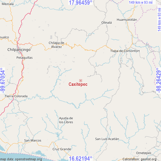
Caxitepec GPS coordinates[2]
17° 17' 40.164" North, 98° 58' 2.676" West
| Map corner | latitude | longitude |
|---|---|---|
| Upper-left | 17.96459°, | -99.67054° |
| Center: | 17.29449°, | -98.96741° |
| Lower-right: | 16.62194°, | -98.26429° |
| Map W x H: | 149.3×149.3 km | = 92.8×92.8mi |
| max Lat: | 32.7° ⇑85.3% North |
| Caxitepec: | 17.29449° |
| min Lat: | ⇓14.7% South 14.53588° |
| min Long | Caxitepec | max Long |
| -117.105° | -98.96741° | -86.73105° |
| W 50.7%⇐ | ⇒49.3% E |
Elevation
Elevation of Caxitepec is 1827 m = 5994 ft, and this is 573.3 m = 1881 ft above average elevation for this country.
| Max E: |
3497 m = 11473 ft | 35.1% |
| Caxitepec | 1827 m 5994 ft | |
| Avg. | 1253.7 m = 4113 ft | |
Min E: |
-1 m = -3 ft | 64.9% |
See also: Mexico elevation on elevation.city.
Geographical zone
Caxitepec is located in North Torrid zone (between Equator and Tropic of Cancer). Distance of this Northern Tropic circle is 683 km =424.4 mi to North.| Distance of | km | miles | from Caxitepec |
|---|---|---|---|
| North Pole | 8084.1 | 5023.2 | to North |
| Arctic Circle | 5478.2 | 3404 | to North |
| Tropic Cancer | 683 | 424.4 | to North |
| Equator | 1923 | 1194.9 | to South |


Nearby cities:
15 places around Caxitepec: (largest is in red/bold)
• Acatepec
7 km =4.3 mi,  61°
61°
• Agua Tordillo
7.8 km =4.8 mi,  195°
195°
• Barranca Pobre
10.3 km =6.4 mi,  118°
118°
• Cacahuatepec
11.3 km =7 mi,  359°
359°
• Chichiltepec
5.8 km =3.6 mi,  35°
35°
• Cuixinipa
4.6 km =2.9 mi,  141°
141°
• El Chirimoyo
10 km =6.2 mi, 56°
• Huixolotepec (Huitzolotepec)
10.4 km =6.5 mi, 37°
• Loma Tuza
12.3 km =7.6 mi, 58°
• Mexcalcingo
10.7 km =6.6 mi,  341°
341°
• Popocatzin
10.8 km =6.7 mi,  328°
328°
• San Marcos
7 km =4.3 mi, 326°
• Tlalchichiltipán Nuevo
12 km =7.5 mi, 343°
• Tonalapa
2.7 km =1.7 mi, 39°
• Zoquitlán
5.6 km =3.5 mi,  20°
20°
Sources, notices
• [Note1] Compared only with cities in Mexico existing in our database
• [Src1] Map data: © OpenStreetMap contributors (CC-BY-SA)
• [Src2] Other city data from geonames.org with taken over terms of usage.
• [Src3] Geographical zone / Annual Mean Temperature by Robert A. Rohde @ Wikipedia
