Tonalapa geodata
Tonalapa (Guerrero) is a populated place; located in Mexico in America/Mexico_City (GMT-6) time zone. With population of 644 people, there are 13427 cities with bigger population in this country. Compared to other cities in Mexico, 85.1% of cities are located further ↑North; 51% of cities are located further ←West and 53.4% of cities have lower elevation than Tonalapa. Note1


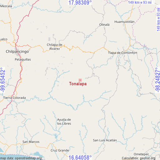
Tonalapa GPS coordinates[2]
17° 18' 47.016" North, 98° 57' 5.004" West
| Map corner | latitude | longitude |
|---|---|---|
| Upper-left | 17.98309°, | -99.65452° |
| Center: | 17.31306°, | -98.95139° |
| Lower-right: | 16.64058°, | -98.24827° |
| Map W x H: | 149.3×149.3 km | = 92.8×92.8mi |
| max Lat: | 32.7° ⇑85.1% North |
| Tonalapa: | 17.31306° |
| min Lat: | ⇓14.9% South 14.53588° |
| min Long | Tonalapa | max Long |
| -117.105° | -98.95139° | -86.73105° |
| W 51%⇐ | ⇒49% E |
Elevation
Elevation of Tonalapa is 1548 m = 5079 ft, and this is 294.3 m = 966 ft above average elevation for this country.
| Max E: |
3497 m = 11473 ft | 46.6% |
| Tonalapa | 1548 m 5079 ft | |
| Avg. | 1253.7 m = 4113 ft | |
Min E: |
-1 m = -3 ft | 53.4% |
See also: Mexico elevation on elevation.city.
Geographical zone
Tonalapa is located in North Torrid zone (between Equator and Tropic of Cancer). Distance of this Northern Tropic circle is 680.9 km =423.1 mi to North.| Distance of | km | miles | from Tonalapa |
|---|---|---|---|
| North Pole | 8082 | 5021.9 | to North |
| Arctic Circle | 5476.1 | 3402.7 | to North |
| Tropic Cancer | 680.9 | 423.1 | to North |
| Equator | 1925 | 1196.1 | to South |


Nearby cities:
15 places around Tonalapa: (largest is in red/bold)
• Acatepec
4.6 km =2.9 mi,  73°
73°
• Agua Tordillo
10.3 km =6.4 mi,  201°
201°
• Barranca Pobre
10.2 km =6.3 mi,  133°
133°
• Cacahuatepec
9.4 km =5.8 mi,  348°
348°
• Cacalotepec
10.6 km =6.6 mi,  40°
40°
• Caxitepec
2.7 km =1.7 mi,  219°
219°
• Chichiltepec
3.1 km =1.9 mi,  31°
31°
• Cuixinipa
5.7 km =3.5 mi,  168°
168°
• El Chirimoyo
7.5 km =4.7 mi,  62°
62°
• Huixolotepec (Huitzolotepec)
7.7 km =4.8 mi, 36°
• Loma Tuza
9.8 km =6.1 mi, 63°
• Mexcalcingo
9.5 km =5.9 mi,  327°
327°
• Popocatzin
10.2 km =6.3 mi,  313°
313°
• San Marcos
6.7 km =4.2 mi,  303°
303°
• Zoquitlán
3.2 km =2 mi,  4°
4°
Sources, notices
• [Note1] Compared only with cities in Mexico existing in our database
• [Src1] Map data: © OpenStreetMap contributors (CC-BY-SA)
• [Src2] Other city data from geonames.org with taken over terms of usage.
• [Src3] Geographical zone / Annual Mean Temperature by Robert A. Rohde @ Wikipedia
