Zacamitla geodata
Zacamitla (Veracruz) is a populated place; located in Mexico in America/Mexico_City (GMT-6) time zone. With population of 728 people, there are 11990 cities with bigger population in this country. Compared to other cities in Mexico, 63.9% of cities are located further ↑North; 75.8% of cities are located further ←West and 55.2% of cities have higher elevation than Zacamitla. Note1


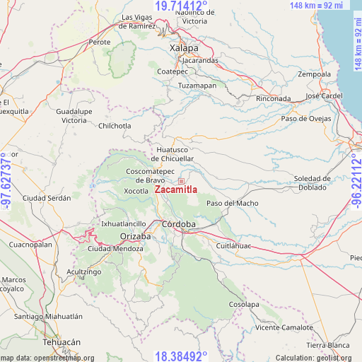
Zacamitla GPS coordinates[2]
19° 3' 3.06" North, 96° 55' 27.264" West
| Map corner | latitude | longitude |
|---|---|---|
| Upper-left | 19.71412°, | -97.62737° |
| Center: | 19.05085°, | -96.92424° |
| Lower-right: | 18.38492°, | -96.22112° |
| Map W x H: | 147.8×147.8 km | = 91.8×91.8mi |
| max Lat: | 32.7° ⇑63.9% North |
| Zacamitla: | 19.05085° |
| min Lat: | ⇓36.1% South 14.53588° |
| min Long | Zacamitla | max Long |
| -117.105° | -96.92424° | -86.73105° |
| W 75.8%⇐ | ⇒24.2% E |
Elevation
Elevation of Zacamitla is 1189 m = 3901 ft, and this is 64.7 m = 212 ft below average elevation for this country.
| Max E: |
3497 m = 11473 ft | 55.2% |
| Avg. | 1253.7 m = 4113 ft | |
| Zacamitla | 1189 m = 3901 ft | |
Min E: |
-1 m = -3 ft | 44.8% |
See also: Mexico elevation on elevation.city.
Geographical zone
Zacamitla is located in North Torrid zone (between Equator and Tropic of Cancer). Distance of this Northern Tropic circle is 487.7 km =303 mi to North.| Distance of | km | miles | from Zacamitla |
|---|---|---|---|
| North Pole | 7888.8 | 4901.9 | to North |
| Arctic Circle | 5282.9 | 3282.6 | to North |
| Tropic Cancer | 487.7 | 303 | to North |
| Equator | 2118.3 | 1316.3 | to South |


Nearby cities:
15 places around Zacamitla: (largest is in red/bold)
• Alta Luz
4.7 km =2.9 mi,  325°
325°
• Amatiopa
7.1 km =4.4 mi,  344°
344°
• Buena Vista
7.2 km =4.5 mi,  97°
97°
• Capulapa
6.6 km =4.1 mi,  35°
35°
• El Bajío
5 km =3.1 mi,  185°
185°
• El Triunfo
6.2 km =3.9 mi,  67°
67°
• Guzmantla
4.1 km =2.5 mi,  179°
179°
• Ixcapantla
5.6 km =3.5 mi,  240°
240°
• Ixcatla
2.8 km =1.7 mi,  11°
11°
• Ixhuatlán del Café
6.3 km =3.9 mi,  270°
270°
• Michapa
6.8 km =4.2 mi, 332°
• Ocotitlán
1.9 km =1.2 mi,  118°
118°
• Presidio
5.4 km =3.4 mi,  292°
292°
• San José Loma Grande
6.4 km =4 mi, 192°
• Tlamatoca
4.9 km =3 mi, 344°
Sources, notices
• [Note1] Compared only with cities in Mexico existing in our database
• [Src1] Map data: © OpenStreetMap contributors (CC-BY-SA)
• [Src2] Other city data from geonames.org with taken over terms of usage.
• [Src3] Geographical zone / Annual Mean Temperature by Robert A. Rohde @ Wikipedia
