San Pedro la Tejería geodata
San Pedro la Tejería (Chiapas) is a populated place; located in Mexico in America/Mexico_City (GMT-6) time zone. With population of 738 people, there are 11838 cities with bigger population in this country. Compared to other cities in Mexico, 92.5% of cities are located further ↑North; 91.8% of cities are located further ←West and 87.6% of cities have lower elevation than San Pedro la Tejería. Note1


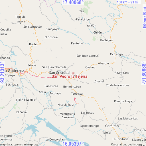
San Pedro la Tejería GPS coordinates[2]
16° 43' 42.636" North, 92° 30' 36" West
| Map corner | latitude | longitude |
|---|---|---|
| Upper-left | 17.40068°, | -93.21313° |
| Center: | 16.72851°, | -92.51° |
| Lower-right: | 16.05397°, | -91.80688° |
| Map W x H: | 149.7×149.7 km | = 93×93mi |
| max Lat: | 32.7° ⇑92.5% North |
| San Pedro la Tejería: | 16.72851° |
| min Lat: | ⇓7.5% South 14.53588° |
| min Long | San Pedro la Te | max Long |
| -117.105° | -92.51° | -86.73105° |
| W 91.8%⇐ | ⇒8.2% E |
Elevation
Elevation of San Pedro la Tejería is 2328 m = 7638 ft, and this is 1074.3 m = 3525 ft above average elevation for this country.
| Max E: |
3497 m = 11473 ft | 12.4% |
| San Pedro la Tejería | 2328 m 7638 ft | |
| Avg. | 1253.7 m = 4113 ft | |
Min E: |
-1 m = -3 ft | 87.6% |
See also: Mexico elevation on elevation.city.
Geographical zone
San Pedro la Tejería is located in North Torrid zone (between Equator and Tropic of Cancer). Distance of this Northern Tropic circle is 745.9 km =463.5 mi to North.| Distance of | km | miles | from San Pedro la Tejería |
|---|---|---|---|
| North Pole | 8147 | 5062.3 | to North |
| Arctic Circle | 5541.1 | 3443.1 | to North |
| Tropic Cancer | 745.9 | 463.5 | to North |
| Equator | 1860 | 1155.8 | to South |


Nearby cities:
15 places around San Pedro la Tejería: (largest is in red/bold)
• Agua de Pajarito
6.1 km =3.8 mi,  277°
277°
• Corazón de María
4.1 km =2.5 mi,  218°
218°
• Cruztón
8.2 km =5.1 mi,  296°
296°
• El Escalón
2.6 km =1.6 mi,  199°
199°
• Eshpuilho
4.3 km =2.7 mi,  117°
117°
• Huixtán
6.4 km =4 mi,  108°
108°
• Jocosic
6.9 km =4.3 mi,  54°
54°
• La Candelaria
2 km =1.2 mi,  322°
322°
• La Sierra
3.9 km =2.4 mi,  244°
244°
• La Soledad
5.9 km =3.7 mi,  189°
189°
• Las Ollas
7.4 km =4.6 mi, 322°
• Lázaro Cárdenas (Chilil)
6.2 km =3.9 mi,  159°
159°
• Matzam
7.6 km =4.7 mi,  27°
27°
• Oquem
3.4 km =2.1 mi,  98°
98°
• Romerillo
7.4 km =4.6 mi, 303°
Sources, notices
• [Note1] Compared only with cities in Mexico existing in our database
• [Src1] Map data: © OpenStreetMap contributors (CC-BY-SA)
• [Src2] Other city data from geonames.org with taken over terms of usage.
• [Src3] Geographical zone / Annual Mean Temperature by Robert A. Rohde @ Wikipedia
