Puentezuelos geodata
Puentezuelos (Veracruz) is a populated place; located in Mexico in America/Mexico_City (GMT-6) time zone. With population of 792 people, there are 11019 cities with bigger population in this country. Compared to other cities in Mexico, 50.8% of cities are located further ↓South; 75.8% of cities are located further ←West and 72.7% of cities have lower elevation than Puentezuelos. Note1


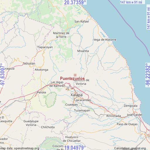
Puentezuelos GPS coordinates[2]
19° 42' 47.016" North, 96° 55' 36.984" West
| Map corner | latitude | longitude |
|---|---|---|
| Upper-left | 20.37359°, | -97.63007° |
| Center: | 19.71306°, | -96.92694° |
| Lower-right: | 19.04979°, | -96.22382° |
| Map W x H: | 147.2×147.2 km | = 91.5×91.5mi |
| max Lat: | 32.7° ⇑49.2% North |
| Puentezuelos: | 19.71306° |
| min Lat: | ⇓50.8% South 14.53588° |
| min Long | Puentezuelos | max Long |
| -117.105° | -96.92694° | -86.73105° |
| W 75.8%⇐ | ⇒24.2% E |
Elevation
Elevation of Puentezuelos is 1982 m = 6503 ft, and this is 728.3 m = 2389 ft above average elevation for this country.
| Max E: |
3497 m = 11473 ft | 27.3% |
| Puentezuelos | 1982 m 6503 ft | |
| Avg. | 1253.7 m = 4113 ft | |
Min E: |
-1 m = -3 ft | 72.7% |
See also: Mexico elevation on elevation.city.
Geographical zone
Puentezuelos is located in North Torrid zone (between Equator and Tropic of Cancer). Distance of this Northern Tropic circle is 414 km =257.2 mi to North.| Distance of | km | miles | from Puentezuelos |
|---|---|---|---|
| North Pole | 7815.2 | 4856.1 | to North |
| Arctic Circle | 5209.3 | 3236.9 | to North |
| Tropic Cancer | 414 | 257.2 | to North |
| Equator | 2191.9 | 1362 | to South |


Nearby cities:
15 places around Puentezuelos: (largest is in red/bold)
• Acatlán
9.1 km =5.7 mi,  101°
101°
• Coacoatzintla
7 km =4.3 mi,  191°
191°
• Duraznal
9.1 km =5.7 mi,  228°
228°
• El Fresno
10.2 km =6.3 mi,  215°
215°
• Etlantepec
6.9 km =4.3 mi,  244°
244°
• Landero y Coss
8.2 km =5.1 mi,  72°
72°
• Las Lomas
10.1 km =6.3 mi,  170°
170°
• Los Planes (Cerro Gordo)
5.5 km =3.4 mi,  180°
180°
• Miahuatlán
5.9 km =3.7 mi, 95°
• Naolinco de Victoria
8.6 km =5.3 mi,  139°
139°
• Piedras Grandes
1.8 km =1.1 mi, 140°
• Salvador Díaz Mirón
9.9 km =6.2 mi,  34°
34°
• San Marcos Atesquilapan
5.1 km =3.2 mi,  120°
120°
• Tlacolulan
9.4 km =5.8 mi, 236°
• Tonayán
3.4 km =2.1 mi, 169°
Sources, notices
• [Note1] Compared only with cities in Mexico existing in our database
• [Src1] Map data: © OpenStreetMap contributors (CC-BY-SA)
• [Src2] Other city data from geonames.org with taken over terms of usage.
• [Src3] Geographical zone / Annual Mean Temperature by Robert A. Rohde @ Wikipedia
