Piedras Grandes geodata
Piedras Grandes (Veracruz) is a populated place; located in Mexico in America/Mexico_City (GMT-6) time zone. With population of 576 people, there are 14877 cities with bigger population in this country. Compared to other cities in Mexico, 50.5% of cities are located further ↓South; 75.9% of cities are located further ←West and 64.6% of cities have lower elevation than Piedras Grandes. Note1


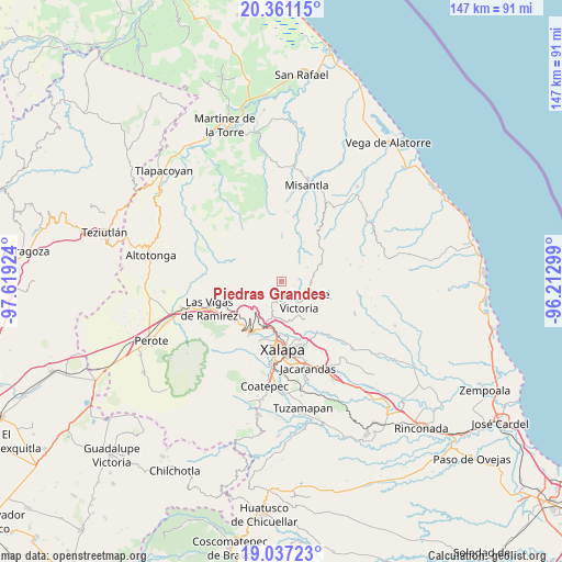
Piedras Grandes GPS coordinates[2]
19° 42' 2.016" North, 96° 54' 57.996" West
| Map corner | latitude | longitude |
|---|---|---|
| Upper-left | 20.36115°, | -97.61924° |
| Center: | 19.70056°, | -96.91611° |
| Lower-right: | 19.03723°, | -96.21299° |
| Map W x H: | 147.2×147.2 km | = 91.5×91.5mi |
| max Lat: | 32.7° ⇑49.5% North |
| Piedras Grandes: | 19.70056° |
| min Lat: | ⇓50.5% South 14.53588° |
| min Long | Piedras Grandes | max Long |
| -117.105° | -96.91611° | -86.73105° |
| W 75.9%⇐ | ⇒24.1% E |
Elevation
Elevation of Piedras Grandes is 1817 m = 5961 ft, and this is 563.3 m = 1848 ft above average elevation for this country.
| Max E: |
3497 m = 11473 ft | 35.4% |
| Piedras Grandes | 1817 m 5961 ft | |
| Avg. | 1253.7 m = 4113 ft | |
Min E: |
-1 m = -3 ft | 64.6% |
See also: Mexico elevation on elevation.city.
Geographical zone
Piedras Grandes is located in North Torrid zone (between Equator and Tropic of Cancer). Distance of this Northern Tropic circle is 415.4 km =258.1 mi to North.| Distance of | km | miles | from Piedras Grandes |
|---|---|---|---|
| North Pole | 7816.6 | 4857 | to North |
| Arctic Circle | 5210.7 | 3237.8 | to North |
| Tropic Cancer | 415.4 | 258.1 | to North |
| Equator | 2190.5 | 1361.1 | to South |


Nearby cities:
15 places around Piedras Grandes: (largest is in red/bold)
• Acatlán
7.8 km =4.8 mi,  93°
93°
• Coacoatzintla
6 km =3.7 mi,  205°
205°
• Duraznal
9.2 km =5.7 mi,  239°
239°
• El Espinal
9.6 km =6 mi,  151°
151°
• El Fresno
9.8 km =6.1 mi,  225°
225°
• Etlantepec
7.5 km =4.7 mi,  257°
257°
• Landero y Coss
7.7 km =4.8 mi,  60°
60°
• Las Lomas
8.6 km =5.3 mi,  176°
176°
• Los Planes (Cerro Gordo)
4.3 km =2.7 mi,  195°
195°
• Miahuatlán
4.8 km =3 mi,  80°
80°
• Naolinco de Victoria
6.8 km =4.2 mi,  138°
138°
• Puentezuelos
1.8 km =1.1 mi,  320°
320°
• San Marcos Atesquilapan
3.4 km =2.1 mi,  110°
110°
• Tlacolulan
9.7 km =6 mi,  247°
247°
• Tonayán
2 km =1.2 mi, 195°
Sources, notices
• [Note1] Compared only with cities in Mexico existing in our database
• [Src1] Map data: © OpenStreetMap contributors (CC-BY-SA)
• [Src2] Other city data from geonames.org with taken over terms of usage.
• [Src3] Geographical zone / Annual Mean Temperature by Robert A. Rohde @ Wikipedia
