La Barranca geodata
La Barranca (Michoacán) is a populated place; located in Mexico in America/Mexico_City (GMT-6) time zone. With population of 780 people, there are 11196 cities with bigger population in this country. Compared to other cities in Mexico, 58.7% of cities are located further ↓South; 76.9% of cities are located further →East and 74.6% of cities have lower elevation than La Barranca. Note1


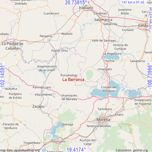
La Barranca GPS coordinates[2]
20° 4' 45.012" North, 101° 26' 34.008" West
| Map corner | latitude | longitude |
|---|---|---|
| Upper-left | 20.73815°, | -102.14591° |
| Center: | 20.07917°, | -101.44278° |
| Lower-right: | 19.4174°, | -100.73966° |
| Map W x H: | 146.9×146.9 km | = 91.3×91.3mi |
| max Lat: | 32.7° ⇑41.3% North |
| La Barranca: | 20.07917° |
| min Lat: | ⇓58.7% South 14.53588° |
| min Long | La Barranca | max Long |
| -117.105° | -101.44278° | -86.73105° |
| W 23.1%⇐ | ⇒76.9% E |
Elevation
Elevation of La Barranca is 2023 m = 6637 ft, and this is 769.3 m = 2524 ft above average elevation for this country.
| Max E: |
3497 m = 11473 ft | 25.4% |
| La Barranca | 2023 m 6637 ft | |
| Avg. | 1253.7 m = 4113 ft | |
Min E: |
-1 m = -3 ft | 74.6% |
See also: Mexico elevation on elevation.city.
Geographical zone
La Barranca is located in North Torrid zone (between Equator and Tropic of Cancer). Distance of this Northern Tropic circle is 373.3 km =232 mi to North.| Distance of | km | miles | from La Barranca |
|---|---|---|---|
| North Pole | 7774.5 | 4830.8 | to North |
| Arctic Circle | 5168.6 | 3211.6 | to North |
| Tropic Cancer | 373.3 | 232 | to North |
| Equator | 2232.6 | 1387.3 | to South |


Nearby cities:
15 places around La Barranca: (largest is in red/bold)
• Batuecas
5.7 km =3.5 mi,  220°
220°
• Cerano
6.7 km =4.2 mi,  60°
60°
• Cerécuaro
10.7 km =6.6 mi,  107°
107°
• Huatajo
11.4 km =7.1 mi,  343°
343°
• La Excusa
8.9 km =5.5 mi,  323°
323°
• Las Tortugas (Emiliano Zapata)
7.4 km =4.6 mi,  24°
24°
• Ojos de Agua de Cerano
8.6 km =5.3 mi,  67°
67°
• Providencia de Calera
12.9 km =8 mi,  25°
25°
• Puruándiro
7.7 km =4.8 mi,  278°
278°
• San Andrés Calera
10.9 km =6.8 mi, 34°
• San Nicolás
13.5 km =8.4 mi, 324°
• San Pedro (San Pedro Carano)
9.2 km =5.7 mi,  307°
307°
• Santa Clara
11.1 km =6.9 mi,  4°
4°
• Tejocote de Calera
12.1 km =7.5 mi, 23°
• Villa Morelos
9 km =5.6 mi,  160°
160°
Sources, notices
• [Note1] Compared only with cities in Mexico existing in our database
• [Src1] Map data: © OpenStreetMap contributors (CC-BY-SA)
• [Src2] Other city data from geonames.org with taken over terms of usage.
• [Src3] Geographical zone / Annual Mean Temperature by Robert A. Rohde @ Wikipedia
