Puruándiro geodata
Puruándiro (Michoacán) is a seat of a second-order administrative division; located in Mexico in America/Mexico_City (GMT-6) time zone. With population of 30,571 people, there are 330 cities with bigger population in this country. Compared to other cities in Mexico, 58.9% of cities are located further ↓South; 77.5% of cities are located further →East and 68% of cities have lower elevation than Puruándiro. Note1


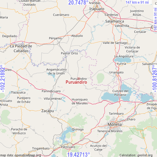
Puruándiro GPS coordinates[2]
20° 5' 19.896" North, 101° 30' 56.844" West
| Map corner | latitude | longitude |
|---|---|---|
| Upper-left | 20.7478°, | -102.21892° |
| Center: | 20.08886°, | -101.51579° |
| Lower-right: | 19.42713°, | -100.81267° |
| Map W x H: | 146.8×146.8 km | = 91.2×91.2mi |
| max Lat: | 32.7° ⇑41.1% North |
| Puruándiro: | 20.08886° |
| min Lat: | ⇓58.9% South 14.53588° |
| min Long | Puruándiro | max Long |
| -117.105° | -101.51579° | -86.73105° |
| W 22.5%⇐ | ⇒77.5% E |
Elevation
Elevation of Puruándiro is 1891 m = 6204 ft, and this is 637.3 m = 2091 ft above average elevation for this country.
| Max E: |
3497 m = 11473 ft | 32% |
| Puruándiro | 1891 m 6204 ft | |
| Avg. | 1253.7 m = 4113 ft | |
Min E: |
-1 m = -3 ft | 68% |
See also: Mexico elevation on elevation.city.
Geographical zone
Puruándiro is located in North Torrid zone (between Equator and Tropic of Cancer). Distance of this Northern Tropic circle is 372.2 km =231.3 mi to North.| Distance of | km | miles | from Puruándiro |
|---|---|---|---|
| North Pole | 7773.4 | 4830.2 | to North |
| Arctic Circle | 5167.5 | 3210.9 | to North |
| Tropic Cancer | 372.2 | 231.3 | to North |
| Equator | 2233.7 | 1388 | to South |


Nearby cities:
15 places around Puruándiro: (largest is in red/bold)
• Batuecas
6.6 km =4.1 mi,  143°
143°
• Cerano
13.6 km =8.5 mi,  80°
80°
• Galeana
8.3 km =5.2 mi,  224°
224°
• Huatajo
10.9 km =6.8 mi,  24°
24°
• Janambo
13.1 km =8.1 mi,  355°
355°
• Janamuato
7.4 km =4.6 mi,  279°
279°
• La Barranca
7.7 km =4.8 mi,  98°
98°
• La Excusa
6.5 km =4 mi, 20°
• Las Tortugas (Emiliano Zapata)
12.1 km =7.5 mi,  61°
61°
• Sabino Buenavista
7.7 km =4.8 mi,  260°
260°
• San José del Reparo
13.2 km =8.2 mi, 357°
• San Nicolás
9.9 km =6.2 mi, 358°
• San Pedro (San Pedro Carano)
4.5 km =2.8 mi,  3°
3°
• Santa Clara
13.2 km =8.2 mi,  40°
40°
• Ururuta
10.8 km =6.7 mi,  242°
242°
Sources, notices
• [Note1] Compared only with cities in Mexico existing in our database
• [Src1] Map data: © OpenStreetMap contributors (CC-BY-SA)
• [Src2] Other city data from geonames.org with taken over terms of usage.
• [Src3] Geographical zone / Annual Mean Temperature by Robert A. Rohde @ Wikipedia
