Zompantle geodata
Zompantle (Guerrero) is a populated place; located in Mexico in America/Mexico_City (GMT-6) time zone. With population of 759 people, there are 11537 cities with bigger population in this country. Compared to other cities in Mexico, 80.9% of cities are located further ↑North; 64.1% of cities are located further →East and 50.1% of cities have lower elevation than Zompantle. Note1


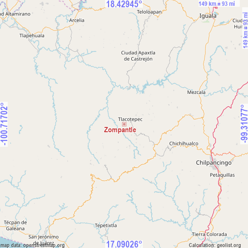
Zompantle GPS coordinates[2]
17° 45' 39.996" North, 100° 0' 50.004" West
| Map corner | latitude | longitude |
|---|---|---|
| Upper-left | 18.42945°, | -100.71702° |
| Center: | 17.76111°, | -100.01389° |
| Lower-right: | 17.09026°, | -99.31077° |
| Map W x H: | 148.9×148.9 km | = 92.5×92.5mi |
| max Lat: | 32.7° ⇑80.9% North |
| Zompantle: | 17.76111° |
| min Lat: | ⇓19.1% South 14.53588° |
| min Long | Zompantle | max Long |
| -117.105° | -100.01389° | -86.73105° |
| W 35.9%⇐ | ⇒64.1% E |
Elevation
Elevation of Zompantle is 1436 m = 4711 ft, and this is 182.3 m = 598 ft above average elevation for this country.
| Max E: |
3497 m = 11473 ft | 49.9% |
| Zompantle | 1436 m 4711 ft | |
| Avg. | 1253.7 m = 4113 ft | |
Min E: |
-1 m = -3 ft | 50.1% |
See also: Mexico elevation on elevation.city.
Geographical zone
Zompantle is located in North Torrid zone (between Equator and Tropic of Cancer). Distance of this Northern Tropic circle is 631.1 km =392.1 mi to North.| Distance of | km | miles | from Zompantle |
|---|---|---|---|
| North Pole | 8032.2 | 4991 | to North |
| Arctic Circle | 5426.3 | 3371.7 | to North |
| Tropic Cancer | 631.1 | 392.1 | to North |
| Equator | 1974.9 | 1227.1 | to South |


Nearby cities:
15 places around Zompantle: (largest is in red/bold)
• Chichiltepec
7.5 km =4.7 mi,  313°
313°
• Corral de Piedra
13.4 km =8.3 mi,  146°
146°
• Durazno del Rosario
11.7 km =7.3 mi,  267°
267°
• Huautla
13.9 km =8.6 mi,  317°
317°
• Huerta Vieja
11.6 km =7.2 mi,  140°
140°
• Izotepec
20.6 km =12.8 mi,  162°
162°
• La Ciénega
16 km =9.9 mi,  66°
66°
• La Venta
12.6 km =7.8 mi,  64°
64°
• Las Vinatas
20.4 km =12.7 mi, 57°
• Los Hoyos
15.3 km =9.5 mi,  236°
236°
• Puerto del Varal
9.1 km =5.7 mi,  130°
130°
• Tlacotenco
9.1 km =5.7 mi,  75°
75°
• Tlacotepec
4.8 km =3 mi,  48°
48°
• Yextla
19.3 km =12 mi, 154°
• Zopilostoc
3.3 km =2.1 mi, 135°
Sources, notices
• [Note1] Compared only with cities in Mexico existing in our database
• [Src1] Map data: © OpenStreetMap contributors (CC-BY-SA)
• [Src2] Other city data from geonames.org with taken over terms of usage.
• [Src3] Geographical zone / Annual Mean Temperature by Robert A. Rohde @ Wikipedia
