Tlacotepec geodata
Tlacotepec (Guerrero) is a seat of a second-order administrative division; located in Mexico in America/Mexico_City (GMT-6) time zone. With population of 6,848 people, there are 1360 cities with bigger population in this country. Compared to other cities in Mexico, 80.6% of cities are located further ↑North; 63.7% of cities are located further →East and 52.9% of cities have lower elevation than Tlacotepec. Note1


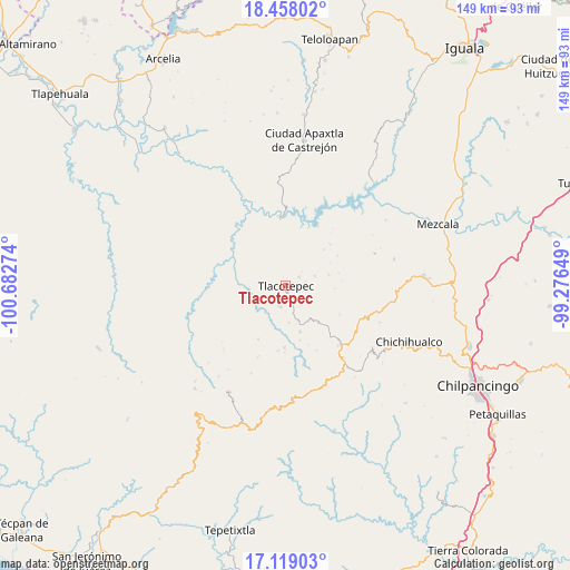
Tlacotepec GPS coordinates[2]
17° 47' 23.208" North, 99° 58' 46.596" West
| Map corner | latitude | longitude |
|---|---|---|
| Upper-left | 18.45802°, | -100.68274° |
| Center: | 17.78978°, | -99.97961° |
| Lower-right: | 17.11903°, | -99.27649° |
| Map W x H: | 148.9×148.9 km | = 92.5×92.5mi |
| max Lat: | 32.7° ⇑80.6% North |
| Tlacotepec: | 17.78978° |
| min Lat: | ⇓19.4% South 14.53588° |
| min Long | Tlacotepec | max Long |
| -117.105° | -99.97961° | -86.73105° |
| W 36.3%⇐ | ⇒63.7% E |
Elevation
Elevation of Tlacotepec is 1540 m = 5052 ft, and this is 286.3 m = 939 ft above average elevation for this country.
| Max E: |
3497 m = 11473 ft | 47.1% |
| Tlacotepec | 1540 m 5052 ft | |
| Avg. | 1253.7 m = 4113 ft | |
Min E: |
-1 m = -3 ft | 52.9% |
See also: Mexico elevation on elevation.city.
Geographical zone
Tlacotepec is located in North Torrid zone (between Equator and Tropic of Cancer). Distance of this Northern Tropic circle is 627.9 km =390.2 mi to North.| Distance of | km | miles | from Tlacotepec |
|---|---|---|---|
| North Pole | 8029 | 4989 | to North |
| Arctic Circle | 5423.1 | 3369.8 | to North |
| Tropic Cancer | 627.9 | 390.2 | to North |
| Equator | 1978 | 1229.1 | to South |


Nearby cities:
15 places around Tlacotepec: (largest is in red/bold)
• Acatlán del Río
18.3 km =11.4 mi,  27°
27°
• Chichiltepec
9.3 km =5.8 mi,  282°
282°
• Corral de Piedra
14.8 km =9.2 mi,  165°
165°
• Durazno del Rosario
15.7 km =9.8 mi,  256°
256°
• Huautla
14.8 km =9.2 mi,  298°
298°
• Huerta Vieja
12.7 km =7.9 mi,  162°
162°
• La Ciénega
11.5 km =7.1 mi,  74°
74°
• La Venta
8.1 km =5 mi, 74°
• Las Vinatas
15.7 km =9.8 mi,  60°
60°
• Los Hoyos
20.1 km =12.5 mi,  234°
234°
• Nuevo Poblado el Caracol
19.3 km =12 mi,  346°
346°
• Puerto del Varal
9.7 km =6 mi, 159°
• Tlacotenco
5.3 km =3.3 mi,  100°
100°
• Zompantle
4.8 km =3 mi, 228°
• Zopilostoc
5.7 km =3.5 mi,  193°
193°
Sources, notices
• [Note1] Compared only with cities in Mexico existing in our database
• [Src1] Map data: © OpenStreetMap contributors (CC-BY-SA)
• [Src2] Other city data from geonames.org with taken over terms of usage.
• [Src3] Geographical zone / Annual Mean Temperature by Robert A. Rohde @ Wikipedia
