Izotepec geodata
Izotepec (Guerrero) is a populated place; located in Mexico in America/Mexico_City (GMT-6) time zone. With population of 1,232 people, there are 7045 cities with bigger population in this country. Compared to other cities in Mexico, 82.3% of cities are located further ↑North; 63.4% of cities are located further →East and 51.4% of cities have higher elevation than Izotepec. Note1


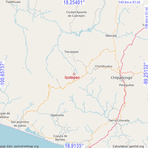
Izotepec GPS coordinates[2]
17° 35' 6" North, 99° 57' 15.984" West
| Map corner | latitude | longitude |
|---|---|---|
| Upper-left | 18.25401°, | -100.65757° |
| Center: | 17.585°, | -99.95444° |
| Lower-right: | 16.9135°, | -99.25132° |
| Map W x H: | 149.1×149.1 km | = 92.6×92.6mi |
| max Lat: | 32.7° ⇑82.3% North |
| Izotepec: | 17.585° |
| min Lat: | ⇓17.7% South 14.53588° |
| min Long | Izotepec | max Long |
| -117.105° | -99.95444° | -86.73105° |
| W 36.6%⇐ | ⇒63.4% E |
Elevation
Elevation of Izotepec is 1364 m = 4475 ft, and this is 110.3 m = 362 ft above average elevation for this country.
| Max E: |
3497 m = 11473 ft | 51.4% |
| Izotepec | 1364 m 4475 ft | |
| Avg. | 1253.7 m = 4113 ft | |
Min E: |
-1 m = -3 ft | 48.6% |
See also: Mexico elevation on elevation.city.
Geographical zone
Izotepec is located in North Torrid zone (between Equator and Tropic of Cancer). Distance of this Northern Tropic circle is 650.7 km =404.3 mi to North.| Distance of | km | miles | from Izotepec |
|---|---|---|---|
| North Pole | 8051.8 | 5003.2 | to North |
| Arctic Circle | 5445.9 | 3383.9 | to North |
| Tropic Cancer | 650.7 | 404.3 | to North |
| Equator | 1955.3 | 1215 | to South |


Nearby cities:
15 places around Izotepec: (largest is in red/bold)
• Campo de Aviación
16.4 km =10.2 mi,  60°
60°
• Carrizal de Bravo
13 km =8.1 mi,  72°
72°
• Colonia General Heliodoro Castillo (Chicahuales)
9 km =5.6 mi,  154°
154°
• Corral de Piedra
8.5 km =5.3 mi,  7°
7°
• El Balzamar
15.4 km =9.6 mi,  94°
94°
• Huerta Vieja
10.7 km =6.6 mi, 5°
• Jaleaca de Catalán
18.4 km =11.4 mi, 146°
• Pueblo Viejo
18.1 km =11.2 mi,  253°
253°
• Puerto General Nicolás Bravo (Filo de Caballos)
13.7 km =8.5 mi, 59°
• Puerto del Varal
13.7 km =8.5 mi,  2°
2°
• Tierra Colorada
17.8 km =11.1 mi,  131°
131°
• Tlacotenco
22 km =13.7 mi, 6°
• Yextla
3 km =1.9 mi,  44°
44°
• Zompantle
20.6 km =12.8 mi,  342°
342°
• Zopilostoc
17.7 km =11 mi,  346°
346°
Sources, notices
• [Note1] Compared only with cities in Mexico existing in our database
• [Src1] Map data: © OpenStreetMap contributors (CC-BY-SA)
• [Src2] Other city data from geonames.org with taken over terms of usage.
• [Src3] Geographical zone / Annual Mean Temperature by Robert A. Rohde @ Wikipedia
