Corral de Piedra geodata
Corral de Piedra (Guerrero) is a populated place; located in Mexico in America/Mexico_City (GMT-6) time zone. With population of 782 people, there are 11169 cities with bigger population in this country. Compared to other cities in Mexico, 81.6% of cities are located further ↑North; 63.2% of cities are located further →East and 55.6% of cities have lower elevation than Corral de Piedra. Note1


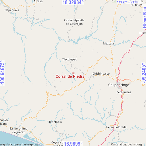
Corral de Piedra GPS coordinates[2]
17° 39' 40.032" North, 99° 56' 37.032" West
| Map corner | latitude | longitude |
|---|---|---|
| Upper-left | 18.32984°, | -100.64675° |
| Center: | 17.66112°, | -99.94362° |
| Lower-right: | 16.9899°, | -99.2405° |
| Map W x H: | 149×149 km | = 92.6×92.6mi |
| max Lat: | 32.7° ⇑81.6% North |
| Corral de Piedra: | 17.66112° |
| min Lat: | ⇓18.4% South 14.53588° |
| min Long | Corral de Piedr | max Long |
| -117.105° | -99.94362° | -86.73105° |
| W 36.8%⇐ | ⇒63.2% E |
Elevation
Elevation of Corral de Piedra is 1604 m = 5262 ft, and this is 350.3 m = 1149 ft above average elevation for this country.
| Max E: |
3497 m = 11473 ft | 44.4% |
| Corral de Piedra | 1604 m 5262 ft | |
| Avg. | 1253.7 m = 4113 ft | |
Min E: |
-1 m = -3 ft | 55.6% |
See also: Mexico elevation on elevation.city.
Geographical zone
Corral de Piedra is located in North Torrid zone (between Equator and Tropic of Cancer). Distance of this Northern Tropic circle is 642.2 km =399 mi to North.| Distance of | km | miles | from Corral de Piedra |
|---|---|---|---|
| North Pole | 8043.3 | 4997.9 | to North |
| Arctic Circle | 5437.4 | 3378.6 | to North |
| Tropic Cancer | 642.2 | 399 | to North |
| Equator | 1963.7 | 1220.2 | to South |


Nearby cities:
15 places around Corral de Piedra: (largest is in red/bold)
• Campo de Aviación
13.2 km =8.2 mi,  91°
91°
• Carrizal de Bravo
12.1 km =7.5 mi,  112°
112°
• Colonia General Heliodoro Castillo (Chicahuales)
16.8 km =10.4 mi,  170°
170°
• El Balzamar
17.2 km =10.7 mi,  124°
124°
• Huerta Vieja
2.2 km =1.4 mi,  358°
358°
• Izotepec
8.5 km =5.3 mi,  187°
187°
• La Ciénega
18.9 km =11.7 mi,  22°
22°
• La Venta
17 km =10.6 mi,  13°
13°
• Puerto General Nicolás Bravo (Filo de Caballos)
10.7 km =6.6 mi,  97°
97°
• Puerto del Varal
5.2 km =3.2 mi,  354°
354°
• Tlacotenco
13.4 km =8.3 mi, 6°
• Tlacotepec
14.8 km =9.2 mi, 345°
• Yextla
6.4 km =4 mi, 171°
• Zompantle
13.4 km =8.3 mi,  326°
326°
• Zopilostoc
10.2 km =6.3 mi, 329°
Sources, notices
• [Note1] Compared only with cities in Mexico existing in our database
• [Src1] Map data: © OpenStreetMap contributors (CC-BY-SA)
• [Src2] Other city data from geonames.org with taken over terms of usage.
• [Src3] Geographical zone / Annual Mean Temperature by Robert A. Rohde @ Wikipedia
