Cinco de Febrero geodata
Cinco de Febrero (Chiapas) is a populated place; located in Mexico in America/Mexico_City (GMT-6) time zone. With population of 755 people, there are 11595 cities with bigger population in this country. Compared to other cities in Mexico, 89% of cities are located further ↑North; 95.9% of cities are located further ←West and 53.2% of cities have higher elevation than Cinco de Febrero. Note1


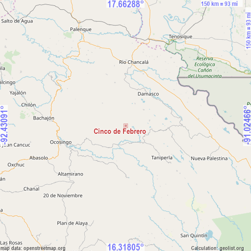
Cinco de Febrero GPS coordinates[2]
16° 59' 30.012" North, 91° 43' 40.008" West
| Map corner | latitude | longitude |
|---|---|---|
| Upper-left | 17.66288°, | -92.43091° |
| Center: | 16.99167°, | -91.72778° |
| Lower-right: | 16.31805°, | -91.02466° |
| Map W x H: | 149.5×149.5 km | = 92.9×92.9mi |
| max Lat: | 32.7° ⇑89% North |
| Cinco de Febrero: | 16.99167° |
| min Lat: | ⇓11% South 14.53588° |
| min Long | Cinco de Febrer | max Long |
| -117.105° | -91.72778° | -86.73105° |
| W 95.9%⇐ | ⇒4.1% E |
Elevation
Elevation of Cinco de Febrero is 1284 m = 4213 ft, and this is 30.3 m = 99 ft above average elevation for this country.
| Max E: |
3497 m = 11473 ft | 53.2% |
| Cinco de Febrero | 1284 m 4213 ft | |
| Avg. | 1253.7 m = 4113 ft | |
Min E: |
-1 m = -3 ft | 46.8% |
See also: Mexico elevation on elevation.city.
Geographical zone
Cinco de Febrero is located in North Torrid zone (between Equator and Tropic of Cancer). Distance of this Northern Tropic circle is 716.6 km =445.3 mi to North.| Distance of | km | miles | from Cinco de Febrero |
|---|---|---|---|
| North Pole | 8117.8 | 5044.2 | to North |
| Arctic Circle | 5511.9 | 3424.9 | to North |
| Tropic Cancer | 716.6 | 445.3 | to North |
| Equator | 1889.3 | 1174 | to South |


Nearby cities:
15 places around Cinco de Febrero: (largest is in red/bold)
• Ach Lum Monte Líbano
14.8 km =9.2 mi,  133°
133°
• El Diamante
15.7 km =9.8 mi,  1°
1°
• El Tumbo
14.5 km =9 mi,  48°
48°
• Jol Sacún
19.5 km =12.1 mi,  314°
314°
• La Reforma
18.8 km =11.7 mi,  258°
258°
• Lacandón
14.5 km =9 mi,  76°
76°
• Miguel Hidalgo
4.7 km =2.9 mi,  21°
21°
• Nueva Esperanza (La Esperanza)
14.4 km =8.9 mi, 22°
• Pamal Navil
12.9 km =8 mi,  322°
322°
• Peña Limonar
14.6 km =9.1 mi,  8°
8°
• Plácido Flores
14.3 km =8.9 mi,  136°
136°
• San Luis (Guadalupe)
12.1 km =7.5 mi,  121°
121°
• San Salvador
16 km =9.9 mi, 262°
• Santa Elena
18.3 km =11.4 mi, 126°
• Zaragoza
9.5 km =5.9 mi, 78°
Sources, notices
• [Note1] Compared only with cities in Mexico existing in our database
• [Src1] Map data: © OpenStreetMap contributors (CC-BY-SA)
• [Src2] Other city data from geonames.org with taken over terms of usage.
• [Src3] Geographical zone / Annual Mean Temperature by Robert A. Rohde @ Wikipedia
