San Luis (Guadalupe) geodata
San Luis (Guadalupe) (Chiapas) is a populated place; located in Mexico in America/Mexico_City (GMT-6) time zone. With population of 556 people, there are 15345 cities with bigger population in this country. Compared to other cities in Mexico, 89.8% of cities are located further ↑North; 96.1% of cities are located further ←West and 64.2% of cities have higher elevation than San Luis (Guadalupe). Note1
Current local time in San Luis (Guadalupe):
06:35 AM, WednesdayDifference from your time zone: hours


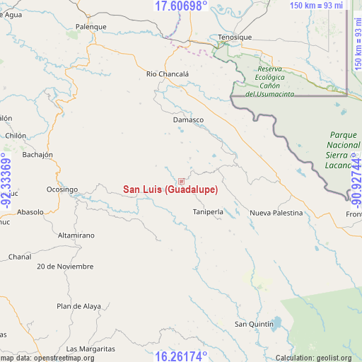
San Luis (Guadalupe) GPS coordinates[2]
16° 56' 8.016" North, 91° 37' 50.016" West
| Map corner | latitude | longitude |
|---|---|---|
| Upper-left | 17.60698°, | -92.33369° |
| Center: | 16.93556°, | -91.63056° |
| Lower-right: | 16.26174°, | -90.92744° |
| Map W x H: | 149.6×149.6 km | = 93×93mi |
| max Lat: | 32.7° ⇑89.8% North |
| San Luis (Guadalupe): | 16.93556° |
| min Lat: | ⇓10.2% South 14.53588° |
| min Long | San Luis (Guada | max Long |
| -117.105° | -91.63056° | -86.73105° |
| W 96.1%⇐ | ⇒3.9% E |
Elevation
Elevation of San Luis (Guadalupe) is 737 m = 2418 ft, and this is 516.7 m = 1695 ft below average elevation for this country.
| Max E: |
3497 m = 11473 ft | 64.2% |
| Avg. | 1253.7 m = 4113 ft | |
| San Luis (Guadalupe) | 737 m = 2418 ft | |
Min E: |
-1 m = -3 ft | 35.8% |
See also: Mexico elevation on elevation.city.
Geographical zone
San Luis (Guadalupe) is located in North Torrid zone (between Equator and Tropic of Cancer). Distance of this Northern Tropic circle is 722.9 km =449.2 mi to North.| Distance of | km | miles | from San Luis (Guadalupe) |
|---|---|---|---|
| North Pole | 8124 | 5048 | to North |
| Arctic Circle | 5518.1 | 3428.8 | to North |
| Tropic Cancer | 722.9 | 449.2 | to North |
| Equator | 1883.1 | 1170.1 | to South |


Nearby cities:
15 places around San Luis (Guadalupe): (largest is in red/bold)
• Ach Lum Monte Líbano
4 km =2.5 mi,  174°
174°
• Agua Azul
17.6 km =10.9 mi,  139°
139°
• Cinco de Febrero
12.1 km =7.5 mi,  301°
301°
• El Censo
11 km =6.8 mi, 137°
• El Jardín
11.2 km =7 mi,  70°
70°
• El Sibal
15.6 km =9.7 mi, 71°
• El Tumbo
15.8 km =9.8 mi,  1°
1°
• Lacandón
10.3 km =6.4 mi,  21°
21°
• Las Tazas
19.9 km =12.4 mi,  175°
175°
• Miguel Hidalgo
13.7 km =8.5 mi,  320°
320°
• Plácido Flores
4.1 km =2.5 mi,  186°
186°
• Santa Elena
6.4 km =4 mi, 137°
• Santa Rita
18.3 km =11.4 mi,  95°
95°
• Taniperla
17 km =10.6 mi, 137°
• Zaragoza
8.2 km =5.1 mi,  352°
352°
Sources, notices
• [Note1] Compared only with cities in Mexico existing in our database
• [Src1] Map data: © OpenStreetMap contributors (CC-BY-SA)
• [Src2] Other city data from geonames.org with taken over terms of usage.
• [Src3] Geographical zone / Annual Mean Temperature by Robert A. Rohde @ Wikipedia
