Atempa geodata
Atempa (Hidalgo) is a populated place; located in Mexico in America/Mexico_City (GMT-6) time zone. With population of 678 people, there are 12811 cities with bigger population in this country. Compared to other cities in Mexico, 74.6% of cities are located further ↓South; 57.4% of cities are located further ←West and 72% of cities have higher elevation than Atempa. Note1


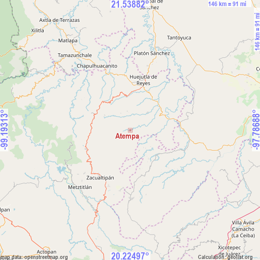
Atempa GPS coordinates[2]
20° 52' 59.988" North, 98° 29' 24" West
| Map corner | latitude | longitude |
|---|---|---|
| Upper-left | 21.53882°, | -99.19313° |
| Center: | 20.88333°, | -98.49° |
| Lower-right: | 20.22497°, | -97.78688° |
| Map W x H: | 146.1×146.1 km | = 90.8×90.8mi |
| max Lat: | 32.7° ⇑25.4% North |
| Atempa: | 20.88333° |
| min Lat: | ⇓74.6% South 14.53588° |
| min Long | Atempa | max Long |
| -117.105° | -98.49° | -86.73105° |
| W 57.4%⇐ | ⇒42.6% E |
Elevation
Elevation of Atempa is 329 m = 1079 ft, and this is 924.7 m = 3034 ft below average elevation for this country.
| Max E: |
3497 m = 11473 ft | 72% |
| Avg. | 1253.7 m = 4113 ft | |
| Atempa | 329 m = 1079 ft | |
Min E: |
-1 m = -3 ft | 28% |
See also: Mexico elevation on elevation.city.
Geographical zone
Atempa is located in North Torrid zone (between Equator and Tropic of Cancer). Distance of this Northern Tropic circle is 283.9 km =176.4 mi to North.| Distance of | km | miles | from Atempa |
|---|---|---|---|
| North Pole | 7685.1 | 4775.3 | to North |
| Arctic Circle | 5079.2 | 3156.1 | to North |
| Tropic Cancer | 283.9 | 176.4 | to North |
| Equator | 2322 | 1442.8 | to South |


Nearby cities:
15 places around Atempa: (largest is in red/bold)
• Aguacatitla
6.9 km =4.3 mi,  110°
110°
• Calnali
10 km =6.2 mi,  278°
278°
• Coacoaco
8.3 km =5.2 mi,  138°
138°
• Coamitla
2.1 km =1.3 mi,  341°
341°
• Coyula
4.8 km =3 mi,  8°
8°
• Papatlatla
4.4 km =2.7 mi,  62°
62°
• Pepeyocatitla
10.2 km =6.3 mi,  70°
70°
• Pilcuatla
9.7 km =6 mi,  319°
319°
• San Andrés (San Andrés Chichayotla)
9 km =5.6 mi,  302°
302°
• San Miguel
9.1 km =5.7 mi,  220°
220°
• Santa Lucía (Mesa de Santa Lucía)
8.1 km =5 mi,  44°
44°
• Tuzancoac
7.4 km =4.6 mi,  244°
244°
• Xoxolpa
6.9 km =4.3 mi,  97°
97°
• Zacatipán
5.5 km =3.4 mi,  203°
203°
• Zoquitipán
6.6 km =4.1 mi, 64°
Sources, notices
• [Note1] Compared only with cities in Mexico existing in our database
• [Src1] Map data: © OpenStreetMap contributors (CC-BY-SA)
• [Src2] Other city data from geonames.org with taken over terms of usage.
• [Src3] Geographical zone / Annual Mean Temperature by Robert A. Rohde @ Wikipedia
