Coacoaco geodata
Coacoaco (Veracruz) is a populated place; located in Mexico in America/Mexico_City (GMT-6) time zone. With population of 800 people, there are 10908 cities with bigger population in this country. Compared to other cities in Mexico, 73.7% of cities are located further ↓South; 58.1% of cities are located further ←West and 62.4% of cities have higher elevation than Coacoaco. Note1


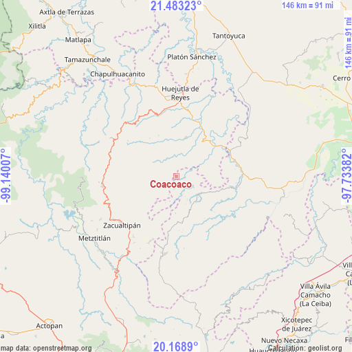
Coacoaco GPS coordinates[2]
20° 49' 39" North, 98° 26' 12.984" West
| Map corner | latitude | longitude |
|---|---|---|
| Upper-left | 21.48323°, | -99.14007° |
| Center: | 20.8275°, | -98.43694° |
| Lower-right: | 20.1689°, | -97.73382° |
| Map W x H: | 146.1×146.1 km | = 90.8×90.8mi |
| max Lat: | 32.7° ⇑26.3% North |
| Coacoaco: | 20.8275° |
| min Lat: | ⇓73.7% South 14.53588° |
| min Long | Coacoaco | max Long |
| -117.105° | -98.43694° | -86.73105° |
| W 58.1%⇐ | ⇒41.9% E |
Elevation
Elevation of Coacoaco is 857 m = 2812 ft, and this is 396.7 m = 1302 ft below average elevation for this country.
| Max E: |
3497 m = 11473 ft | 62.4% |
| Avg. | 1253.7 m = 4113 ft | |
| Coacoaco | 857 m = 2812 ft | |
Min E: |
-1 m = -3 ft | 37.6% |
See also: Mexico elevation on elevation.city.
Geographical zone
Coacoaco is located in North Torrid zone (between Equator and Tropic of Cancer). Distance of this Northern Tropic circle is 290.1 km =180.3 mi to North.| Distance of | km | miles | from Coacoaco |
|---|---|---|---|
| North Pole | 7691.3 | 4779.2 | to North |
| Arctic Circle | 5085.4 | 3159.9 | to North |
| Tropic Cancer | 290.1 | 180.3 | to North |
| Equator | 2315.8 | 1439 | to South |


Nearby cities:
15 places around Coacoaco: (largest is in red/bold)
• Aguacatitla
3.9 km =2.4 mi,  13°
13°
• Arnatepec
4.9 km =3 mi,  142°
142°
• Atempa
8.3 km =5.2 mi,  164°
164°
• Atempa
8.3 km =5.2 mi,  318°
318°
• Chahuatlán
6.7 km =4.2 mi, 137°
• Huitztipan
7.7 km =4.8 mi,  82°
82°
• Ilamatlán
5.3 km =3.3 mi,  187°
187°
• Papatlatla
8.4 km =5.2 mi,  349°
349°
• San Gregorio
4.9 km =3 mi,  99°
99°
• Santa Cruz
3.9 km =2.4 mi,  152°
152°
• Santa Teresa
8.9 km =5.5 mi,  38°
38°
• Tlatlazoquico
8.4 km =5.2 mi, 95°
• Xalacahuantla
7.4 km =4.6 mi,  231°
231°
• Xoxolpa
5.5 km =3.4 mi, 14°
• Zacatipán
7.8 km =4.8 mi,  278°
278°
Sources, notices
• [Note1] Compared only with cities in Mexico existing in our database
• [Src1] Map data: © OpenStreetMap contributors (CC-BY-SA)
• [Src2] Other city data from geonames.org with taken over terms of usage.
• [Src3] Geographical zone / Annual Mean Temperature by Robert A. Rohde @ Wikipedia
