Xoxolpa geodata
Xoxolpa (Hidalgo) is a populated place; located in Mexico in America/Mexico_City (GMT-6) time zone. With population of 1,197 people, there are 7253 cities with bigger population in this country. Compared to other cities in Mexico, 74.4% of cities are located further ↓South; 58.3% of cities are located further ←West and 66.2% of cities have higher elevation than Xoxolpa. Note1


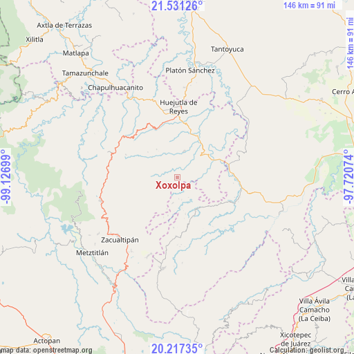
Xoxolpa GPS coordinates[2]
20° 52' 32.664" North, 98° 25' 25.896" West
| Map corner | latitude | longitude |
|---|---|---|
| Upper-left | 21.53126°, | -99.12699° |
| Center: | 20.87574°, | -98.42386° |
| Lower-right: | 20.21735°, | -97.72074° |
| Map W x H: | 146.1×146.1 km | = 90.8×90.8mi |
| max Lat: | 32.7° ⇑25.6% North |
| Xoxolpa: | 20.87574° |
| min Lat: | ⇓74.4% South 14.53588° |
| min Long | Xoxolpa | max Long |
| -117.105° | -98.42386° | -86.73105° |
| W 58.3%⇐ | ⇒41.7% E |
Elevation
Elevation of Xoxolpa is 629 m = 2064 ft, and this is 624.7 m = 2050 ft below average elevation for this country.
| Max E: |
3497 m = 11473 ft | 66.2% |
| Avg. | 1253.7 m = 4113 ft | |
| Xoxolpa | 629 m = 2064 ft | |
Min E: |
-1 m = -3 ft | 33.8% |
See also: Mexico elevation on elevation.city.
Geographical zone
Xoxolpa is located in North Torrid zone (between Equator and Tropic of Cancer). Distance of this Northern Tropic circle is 284.8 km =177 mi to North.| Distance of | km | miles | from Xoxolpa |
|---|---|---|---|
| North Pole | 7685.9 | 4775.8 | to North |
| Arctic Circle | 5080 | 3156.6 | to North |
| Tropic Cancer | 284.8 | 177 | to North |
| Equator | 2321.2 | 1442.3 | to South |


Nearby cities:
15 places around Xoxolpa: (largest is in red/bold)
• Aguacatitla
1.7 km =1.1 mi,  195°
195°
• Atempa
6.9 km =4.3 mi,  277°
277°
• Coacoaco
5.5 km =3.4 mi,  194°
194°
• Coamitla
8.1 km =5 mi,  290°
290°
• Coyula
8.4 km =5.2 mi,  312°
312°
• Huitztipan
7.7 km =4.8 mi,  124°
124°
• Mecatlán
7 km =4.3 mi,  17°
17°
• Papatlatla
4.1 km =2.5 mi, 314°
• Pepeyocatitla
5.1 km =3.2 mi,  32°
32°
• San Gregorio
7.1 km =4.4 mi,  150°
150°
• Santa Lucía (Mesa de Santa Lucía)
6.8 km =4.2 mi,  349°
349°
• Santa Teresa
4.5 km =2.8 mi,  69°
69°
• Tenamaxtepec
6.5 km =4 mi,  82°
82°
• Tetla
8.4 km =5.2 mi,  53°
53°
• Zoquitipán
3.8 km =2.4 mi, 346°
Sources, notices
• [Note1] Compared only with cities in Mexico existing in our database
• [Src1] Map data: © OpenStreetMap contributors (CC-BY-SA)
• [Src2] Other city data from geonames.org with taken over terms of usage.
• [Src3] Geographical zone / Annual Mean Temperature by Robert A. Rohde @ Wikipedia
